
23 Bus Route Map
View the 23 route map and see all 23 stops along the route. The map of 23 shows where the bus travels and the location of each stop, making it easy to understand the entire route at a glance.
Explore Franklin Regional Transit Authority routes on the map and see where Franklin Regional Transit Authority bus services operate. Use the 23 map to find bus stops and see how the 23 connects different areas along its trip.
All 23 stops on the map are displayed in route order, helping you follow the 23 bus from the first stop to the last.
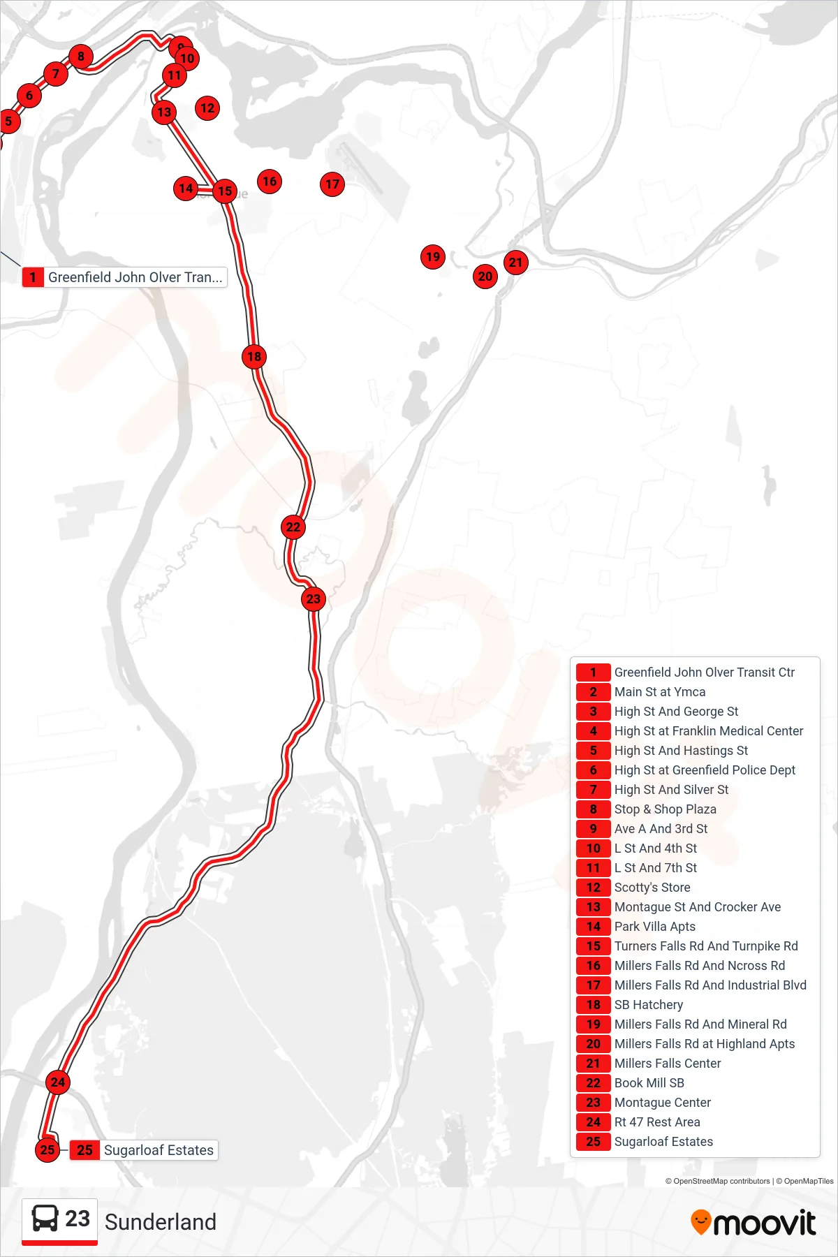
Stops list (23 - Sugarloaf Estates)
- Greenfield John Olver Transit Ctr
- Main St at Ymca
- High St And George St
- High St at Franklin Medical Center
- High St And Hastings St
- High St at Greenfield Police Dept
- High St And Silver St
- Stop & Shop Plaza
- Ave A And 3rd St
- L St And 4th St
- L St And 7th St
- Scotty's Store
- Montague St And Crocker Ave
- Park Villa Apts
- Turners Falls Rd And Turnpike Rd
- Millers Falls Rd And Ncross Rd
- Millers Falls Rd And Industrial Blvd
- SB Hatchery
- Millers Falls Rd And Mineral Rd
- Millers Falls Rd at Highland Apts
- Millers Falls Center
- Book Mill SB
- Montague Center
- Rt 47 Rest Area
- Sugarloaf Estates