
23 Bus Route Map
View the 23 route map and see all 23 stops along the route. The map of 23 shows where the bus travels and the location of each stop, making it easy to understand the entire route at a glance.
Explore The Ride routes on the map and see where The Ride bus services operate. Use the 23 map to find bus stops and see how the 23 connects different areas along its trip.
All 23 stops on the map are displayed in route order, helping you follow the 23 bus from the first stop to the last.
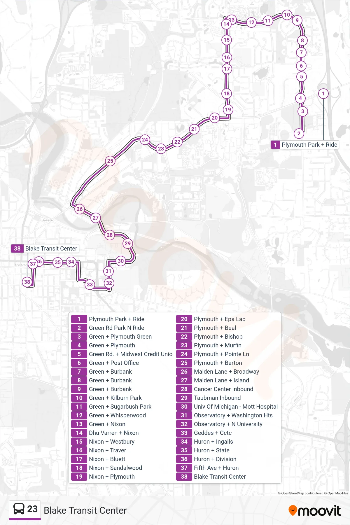
Stops list (23 - Blake Transit Center)
- Plymouth Park + Ride
- Green Rd Park N Ride
- Green + Plymouth Green
- Green + Plymouth
- Green Rd. + Midwest Credit Unio
- Green + Post Office
- Green + Burbank
- Green + Burbank
- Green + Burbank
- Green + Kilburn Park
- Green + Sugarbush Park
- Green + Whisperwood
- Green + Nixon
- Dhu Varren + Nixon
- Nixon + Westbury
- Nixon + Traver
- Nixon + Bluett
- Nixon + Sandalwood
- Nixon + Plymouth
- Plymouth + Epa Lab
- Plymouth + Beal
- Plymouth + Bishop
- Plymouth + Murfin
- Plymouth + Pointe Ln
- Plymouth + Barton
- Maiden Lane + Broadway
- Maiden Lane + Island
- Cancer Center Inbound
- Taubman Inbound
- Univ Of Michigan - Mott Hospital
- Observatory + Washington Hts
- Observatory + N University
- Geddes + Cctc
- Huron + Ingalls
- Huron + State
- Huron + Division
- Fifth Ave + Huron
- Blake Transit Center