
23 Bus Route Map
View the 23 route map and see all 23 stops along the route. The map of 23 shows where the bus travels and the location of each stop, making it easy to understand the entire route at a glance.
Explore Pistoia and Province - Tuscan Bus Lines routes on the map and see where Pistoia and Province - Tuscan Bus Lines bus services operate. Use the 23 map to find bus stops and see how the 23 connects different areas along its trip.
All 23 stops on the map are displayed in route order, helping you follow the 23 bus from the first stop to the last.
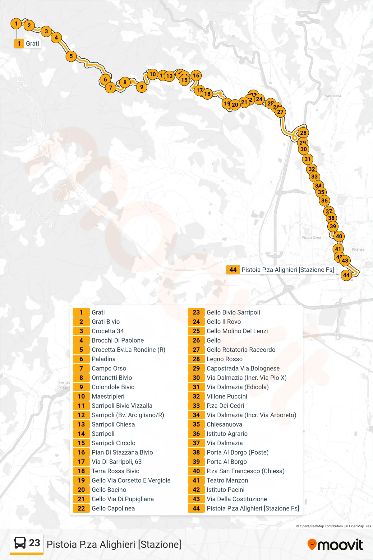
Stops list (23 - Pistoia P.za Alighieri [Stazione])
- Grati
- Grati Junction
- Crocetta 34
- Brocchi di Paolone
- Crocetta La Rondine Junction
- Paladina
- Campo Orso
- Ontanetti Junction
- Colondole Junction
- Maestripieri
- Sarripoli Vizzalla Junction
- Sarripoli (Arcigliano Blvd/R)
- Sarripoli Church
- Sarripoli
- Sarripoli Circle
- Pian Di Stazzana Junction
- Via Di Sarripoli, 63
- Terra Rossa Junction
- Gello Via Corsetto and Vergiole
- Gello Basin
- Gello Pupigliana Road
- Gello Terminal
- Gello Sarripoli Junction
- Gello Il Rovo
- Gello Lenzi Mill
- Gello
- Gello Roundabout Junction
- Red Wood
- Capostrada Bologna Road
- Via Dalmazia (Intersection Via Pio X)
- Via Dalmazia (Newsstand)
- Villone Puccini
- Cedar Square
- Via Dalmazia (Intersection Via Arboreto)
- Chiesanuova
- Agricultural Institute
- Dalmazia Street
- Porta Al Borgo (Post Office)
- Porta Al Borgo
- San Francesco Square (Church)
- Manzoni Theater
- Pacini Institute
- Della Costituzione Street
- Pistoia Alighieri Square [Railway Station]