
23 Bus Route Map
View the 23 route map and see all 23 stops along the route. The map of 23 shows where the bus travels and the location of each stop, making it easy to understand the entire route at a glance.
Explore Bus Átha Cliath – Dublin Bus routes on the map and see where Bus Átha Cliath – Dublin Bus bus services operate. Use the 23 map to find bus stops and see how the 23 connects different areas along its trip.
All 23 stops on the map are displayed in route order, helping you follow the 23 bus from the first stop to the last.
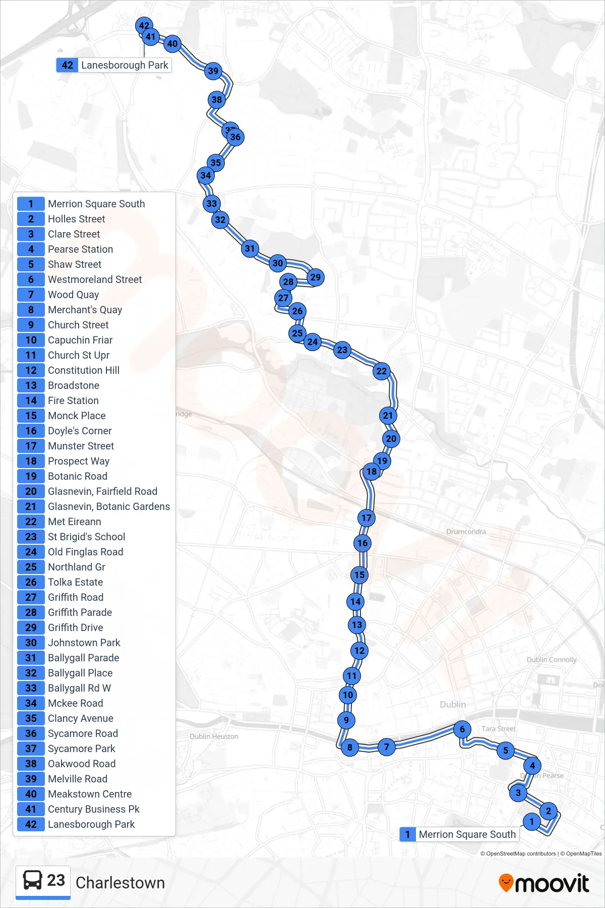
Stops list (23 - Charlestown)
- Merrion Square South
- Holles Street
- Clare Street
- Pearse Station
- Shaw Street
- Westmoreland Street
- Wood Quay
- Merchant's Quay
- Church Street
- Capuchin Friar
- Church St Upr
- Constitution Hill
- Broadstone
- Fire Station
- Monck Place
- Doyle's Corner
- Munster Street
- Prospect Way
- Botanic Road
- Glasnevin, Fairfield Road
- Glasnevin, Botanic Gardens
- Met Eireann
- St Brigid's School
- Old Finglas Road
- Northland Gr
- Tolka Estate
- Griffith Road
- Griffith Parade
- Griffith Drive
- Johnstown Park
- Ballygall Parade
- Ballygall Place
- Ballygall Rd W
- Mckee Road
- Clancy Avenue
- Sycamore Road
- Sycamore Park
- Oakwood Road
- Melville Road
- Meakstown Centre
- Century Business Pk
- Lanesborough Park