
23 Bus Route Map
View the 23 route map and see all 23 stops along the route. The map of 23 shows where the bus travels and the location of each stop, making it easy to understand the entire route at a glance.
Explore Montgomery County Ride On routes on the map and see where Montgomery County Ride On bus services operate. Use the 23 map to find bus stops and see how the 23 connects different areas along its trip.
All 23 stops on the map are displayed in route order, helping you follow the 23 bus from the first stop to the last.
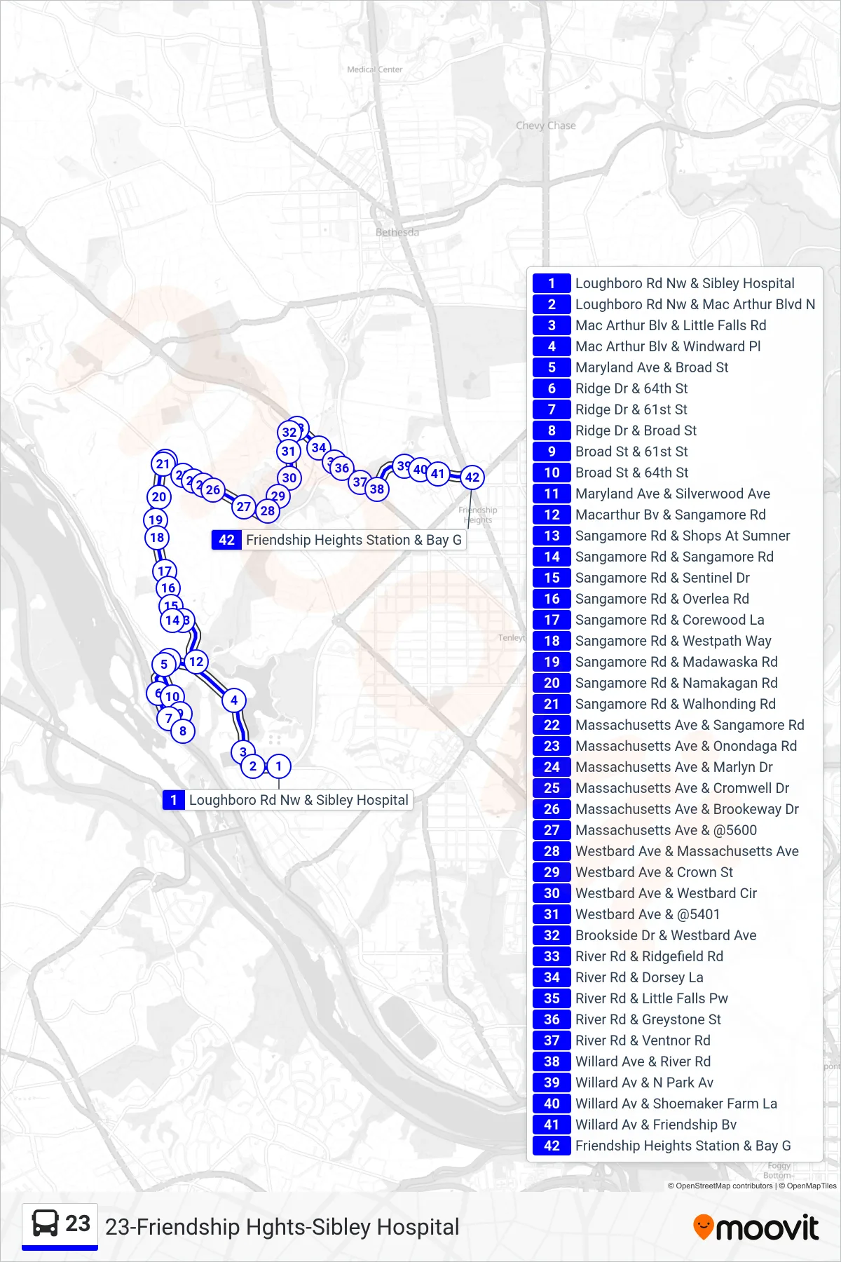
Stops list (23 - Friendship Heights)
- Loughboro Rd Nw & Sibley Hospital
- Loughboro Rd Nw & Mac Arthur Blvd N
- Mac Arthur Blv & Little Falls Rd
- Mac Arthur Blv & Windward Pl
- Maryland Ave & Broad St
- Ridge Dr & 64th St
- Ridge Dr & 61st St
- Ridge Dr & Broad St
- Broad St & 61st St
- Broad St & 64th St
- Maryland Ave & Silverwood Ave
- Macarthur Bv & Sangamore Rd
- Sangamore Rd & Shops At Sumner
- Sangamore Rd & Sangamore Rd
- Sangamore Rd & Sentinel Dr
- Sangamore Rd & Overlea Rd
- Sangamore Rd & Corewood La
- Sangamore Rd & Westpath Way
- Sangamore Rd & Madawaska Rd
- Sangamore Rd & Namakagan Rd
- Sangamore Rd & Walhonding Rd
- Massachusetts Ave & Sangamore Rd
- Massachusetts Ave & Onondaga Rd
- Massachusetts Ave & Marlyn Dr
- Massachusetts Ave & Cromwell Dr
- Massachusetts Ave & Brookeway Dr
- Massachusetts Ave & @5600
- Westbard Ave & Massachusetts Ave
- Westbard Ave & Crown St
- Westbard Ave & Westbard Cir
- Westbard Ave & @5401
- Brookside Dr & Westbard Ave
- River Rd & Ridgefield Rd
- River Rd & Dorsey La
- River Rd & Little Falls Pw
- River Rd & Greystone St
- River Rd & Ventnor Rd
- Willard Ave & River Rd
- Willard Av & N Park Av
- Willard Av & Shoemaker Farm La
- Willard Av & Friendship Bv
- Friendship Heights Station & Bay G