
24 Bus Route Map
View the 24 route map and see all 24 stops along the route. The map of 24 shows where the bus travels and the location of each stop, making it easy to understand the entire route at a glance.
Explore KYMA MOBILITY routes on the map and see where KYMA MOBILITY bus services operate. Use the 24 map to find bus stops and see how the 24 connects different areas along its trip.
All 24 stops on the map are displayed in route order, helping you follow the 24 bus from the first stop to the last.
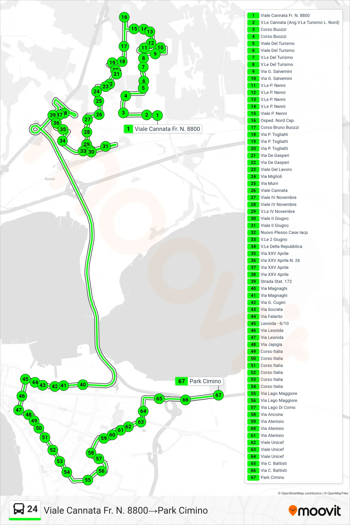
Stops list (24 - Cannata Avenue No. 8800→Cimino Park)
- Cannata Avenue No. 8800
- Cannata Avenue (Corner of Tourism Avenue North Side)
- Buozzi Course
- Buozzi Course
- Tourism Avenue
- Tourism Avenue
- Tourism Avenue
- Tourism Avenue
- G. Salvemini Street
- Via G. Salvemini
- P. Nenni Avenue
- P. Nenni Avenue
- P. Nenni Avenue
- P. Nenni Avenue
- P. Nenni Avenue
- North Hospital Terminal
- Bruno Buozzi Avenue
- P. Togliatti Street
- P. Togliatti Street
- P. Togliatti Street
- De Gasperi Street
- De Gasperi Street
- Lavoro Avenue
- Miglioli Street
- Murri Street
- Cannata Avenue
- IV November Avenue
- IV November Avenue
- November 4th Avenue
- II June Avenue
- II June Avenue
- New IACP Housing Complex
- June 2nd Avenue
- Republic Avenue
- XXV Aprile Street
- 25th April Street No. 26
- XXV Aprile Street
- XXV Aprile Street
- State Road 172
- Magnaghi Street
- Magnaghi Street
- G. Cugini Street
- Socrates Street
- Via Falanto
- Leonida - 8/10
- Leonida Street
- Leonida Street
- Via Japigia
- Italy Course
- Italy Course
- Italy Course
- Italy Course
- Italy Course
- Italy Course
- Lago Maggiore Street
- Lago Maggiore Street
- Lake Como Street
- Ancona Street
- Via Atenisio
- Via Atenisio
- Via Atenisio
- UNICEF Avenue
- UNICEF Avenue
- UNICEF Avenue
- C. Battisti Street
- C. Battisti Street
- Cimino Park