
24 Bus Route Map
View the 24 route map and see all 24 stops along the route. The map of 24 shows where the bus travels and the location of each stop, making it easy to understand the entire route at a glance.
Explore FARGO routes on the map and see where FARGO bus services operate. Use the 24 map to find bus stops and see how the 24 connects different areas along its trip.
All 24 stops on the map are displayed in route order, helping you follow the 24 bus from the first stop to the last.
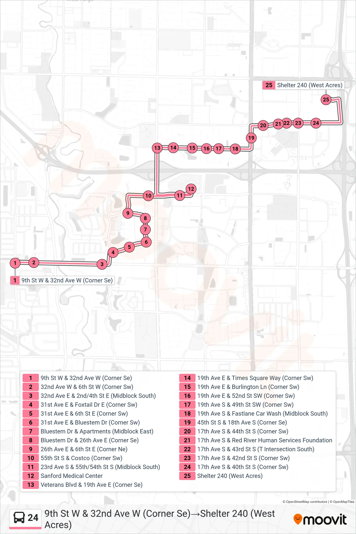
Stops list (24 - 9th St W & 32nd Ave W (Corner Se)→Shelter 240 (West Acres))
- 9th St W & 32nd Ave W (Corner Se)
- 32nd Ave W & 6th St W (Corner Sw)
- 32nd Ave E & 2nd/4th St E (Midblock South)
- 31st Ave E & Foxtail Dr E (Corner Sw)
- 31st Ave E & 6th St E (Corner Sw)
- 31st Ave E & Bluestem Dr (Corner Sw)
- Bluestem Dr & Apartments (Midblock East)
- Bluestem Dr & 26th Ave E (Corner Se)
- 26th Ave E & 6th St E (Corner Ne)
- 55th St S & Costco (Corner Sw)
- 23rd Ave S & 55th/54th St S (Midblock South)
- Sanford Medical Center
- Veterans Blvd & 19th Ave E (Corner Se)
- 19th Ave E & Times Square Way (Corner Sw)
- 19th Ave E & Burlington Ln (Corner Sw)
- 19th Ave E & 52nd St SW (Corner Sw)
- 19th Ave S & 49th St SW (Corner Sw)
- 19th Ave S & Fastlane Car Wash (Midblock South)
- 45th St S & 18th Ave S (Corner Se)
- 17th Ave S & 44th St S (Corner Sw)
- 17th Ave S & Red River Human Services Foundation
- 17th Ave S & 43rd St S (T Intersection South)
- 17th Ave S & 42nd St S (Corner Sw)
- 17th Ave S & 40th St S (Corner Sw)
- Shelter 240 (West Acres)