
24 Bus Route Map
View the 24 route map and see all 24 stops along the route. The map of 24 shows where the bus travels and the location of each stop, making it easy to understand the entire route at a glance.
Explore Nateev Express routes on the map and see where Nateev Express bus services operate. Use the 24 map to find bus stops and see how the 24 connects different areas along its trip.
All 24 stops on the map are displayed in route order, helping you follow the 24 bus from the first stop to the last.
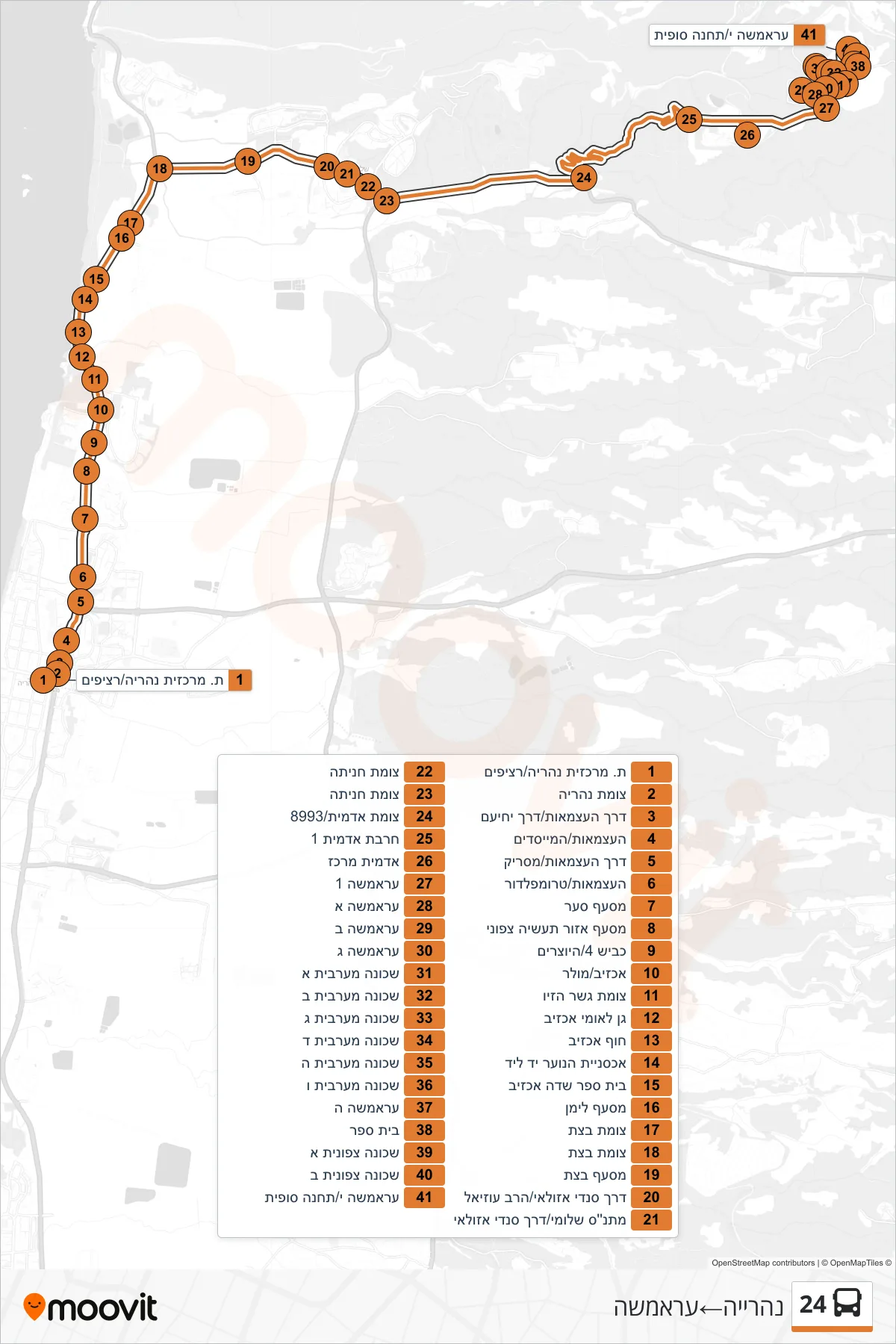
Stops list (24 - Nahariya→Aramsha)
- Nahariya Central Station/Platforms
- Nahariya Junction
- Independence Road/Yehiam Road
- HaAtzmaut/HaMeyasdim
- Independence Road/Masaryk
- HaAtzmaut/Trumpeldor
- Sa'ar Junction
- Northern Industrial Zone Junction
- Road 4/HaYotzrim
- Achziv/Muller
- Gesher HaZiv Junction
- Achziv National Park
- Achziv Beach
- Youth Hostel Yad LeYad
- Achziv Field School
- Liman Junction
- Betzet Junction
- Betzet Junction
- Betzet Junction
- Sandy Azulai Road/Rabbi Uziel
- Shlomi Community Center/Sandy Azulai Way
- Hanita Junction
- Hanita Junction
- Adamit Junction/8993
- Horvat Admit 1
- Adamit Center
- Aramsha 1
- Aramsha A
- Aramsha B
- Aramsha C
- Western Neighborhood A
- Western Neighborhood B
- Western Neighborhood C
- Western Neighborhood D
- Western Neighborhood H
- Western Neighborhood F
- Aramsha E
- School
- Northern Neighborhood A
- Northern Neighborhood B
- Aramsha Y/Terminal