
24 Bus Route Map
View the 24 route map and see all 24 stops along the route. The map of 24 shows where the bus travels and the location of each stop, making it easy to understand the entire route at a glance.
Explore Regionalbuslinien routes on the map and see where Regionalbuslinien bus services operate. Use the 24 map to find bus stops and see how the 24 connects different areas along its trip.
All 24 stops on the map are displayed in route order, helping you follow the 24 bus from the first stop to the last.
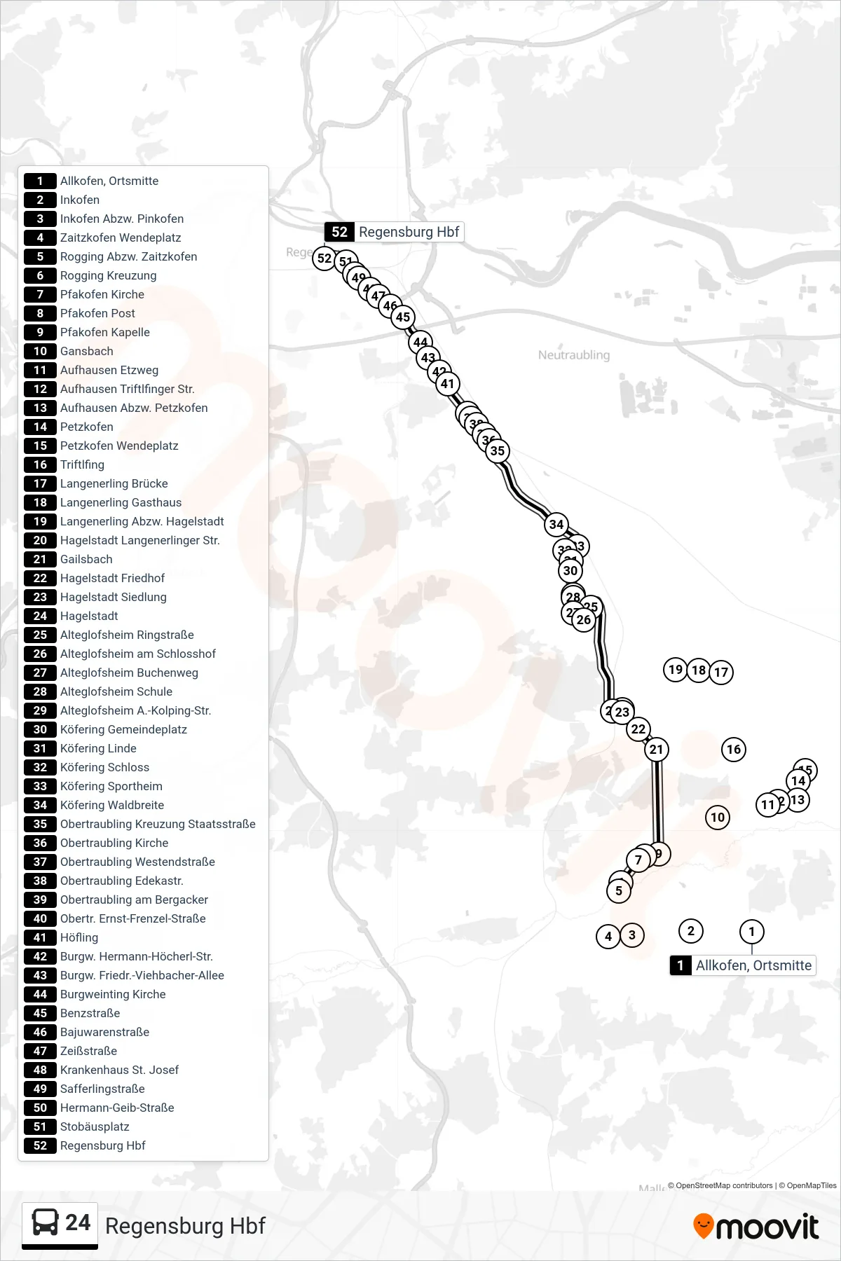
Stops list (24 - Regensburg Hbf)
- Allkofen, Ortsmitte
- Inkofen
- Inkofen Abzw. Pinkofen
- Zaitzkofen Wendeplatz
- Rogging Abzw. Zaitzkofen
- Rogging Kreuzung
- Pfakofen Kirche
- Pfakofen Post
- Pfakofen Kapelle
- Gansbach
- Aufhausen Etzweg
- Aufhausen Triftlfinger Str.
- Aufhausen Abzw. Petzkofen
- Petzkofen
- Petzkofen Wendeplatz
- Triftlfing
- Langenerling Brücke
- Langenerling Gasthaus
- Langenerling Abzw. Hagelstadt
- Hagelstadt Langenerlinger Str.
- Gailsbach
- Hagelstadt Friedhof
- Hagelstadt Siedlung
- Hagelstadt
- Alteglofsheim Ringstraße
- Alteglofsheim am Schlosshof
- Alteglofsheim Buchenweg
- Alteglofsheim Schule
- Alteglofsheim A.-Kolping-Str.
- Köfering Gemeindeplatz
- Köfering Linde
- Köfering Schloss
- Köfering Sportheim
- Köfering Waldbreite
- Obertraubling Kreuzung Staatsstraße
- Obertraubling Kirche
- Obertraubling Westendstraße
- Obertraubling Edekastr.
- Obertraubling am Bergacker
- Obertr. Ernst-Frenzel-Straße
- Höfling
- Burgw. Hermann-Höcherl-Str.
- Burgw. Friedr.-Viehbacher-Allee
- Burgweinting Kirche
- Benzstraße
- Bajuwarenstraße
- Zeißstraße
- Krankenhaus St. Josef
- Safferlingstraße
- Hermann-Geib-Straße
- Stobäusplatz
- Regensburg Hbf