
24 Tram Route Map
View the 24 route map and see all 24 stops along the route. The map of 24 shows where the tram travels and the location of each stop, making it easy to understand the entire route at a glance.
Explore routes on the map and see where tram services operate. Use the 24 map to find tram stations and see how the 24 connects different areas along its trip.
All 24 stops on the map are displayed in route order, helping you follow the 24 tram from the first station to the last.
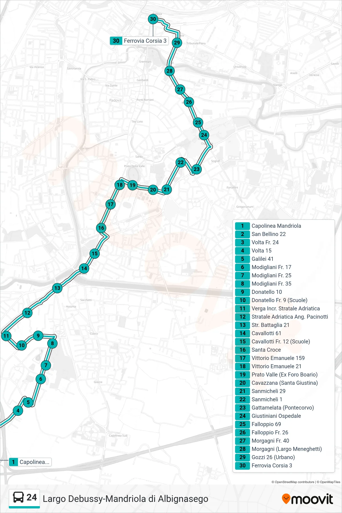
Stops list (24 - Mandriola Terminal to Railway)
- Mandriola Terminal
- San Bellino 22
- Volta Near 24
- Volta 15
- Galilei 41
- 17 Modigliani
- Modigliani Stop 25
- Modigliani 35
- Donatello 10
- Donatello Opposite 9 (Schools)
- Verga Adriatic Road Junction
- Adriatic Highway Pacinotti Corner
- Battaglia St 21
- Cavallotti 61
- Cavallotti 12 (Schools)
- Santa Croce
- Vittorio Emanuele 159
- Vittorio Emanuele 21
- Prato Valle (Former Cattle Market)
- Cavazzana (Santa Giustina)
- Sanmicheli 29
- Sanmicheli 1
- Gattamelata (Pontecorvo)
- Giustiniani Hospital
- Falloppio 69
- Falloppio No. 26
- Morgagni No. 40
- Morgagni (Largo Meneghetti)
- Gozzi 26 (Urban)
- Railway Track 3
Change direction
- Route Map - 24 - Capolinea Sud Tram > Mandriola
- Route Map - 24 - Albignasego Monument Terminal > Railway
- Route Map - 24 - North Tram Terminal to Mandriola via Railway
- Route Map - 24 - Largo Debussy > Mandriola Terminal
- Route Map - 24 - Railway (Ex Land Registry) to Mandriola Terminal
- Route Map - 24 - Mandriola to Debussy Terminal
- Route Map - 24 - Borgomagno ➡️ Plebiscito ➡️ Capolinea Largo Debussy
- Route Map - 24 - Mandriola > Prato Valle > Riviera Tito Livio > Severi School Terminal
- Route Map - 24 - Largo Debussy Terminal to Railway (Ex Cadastre)
- Route Map - 24 - Mandriola > Capolinea Sud Tram
- Route Map - 24 - Mandriola > Riviera Tito Livio > Terminus Largo Debussy
- Route Map - 24 - Tommaseo Skyscraper > North Tram Terminal