
24 Bus Route Map
View the 24 route map and see all 24 stops along the route. The map of 24 shows where the bus travels and the location of each stop, making it easy to understand the entire route at a glance.
Explore Consórcio TRANSNIT routes on the map and see where Consórcio TRANSNIT bus services operate. Use the 24 map to find bus stops and see how the 24 connects different areas along its trip.
All 24 stops on the map are displayed in route order, helping you follow the 24 bus from the first stop to the last.
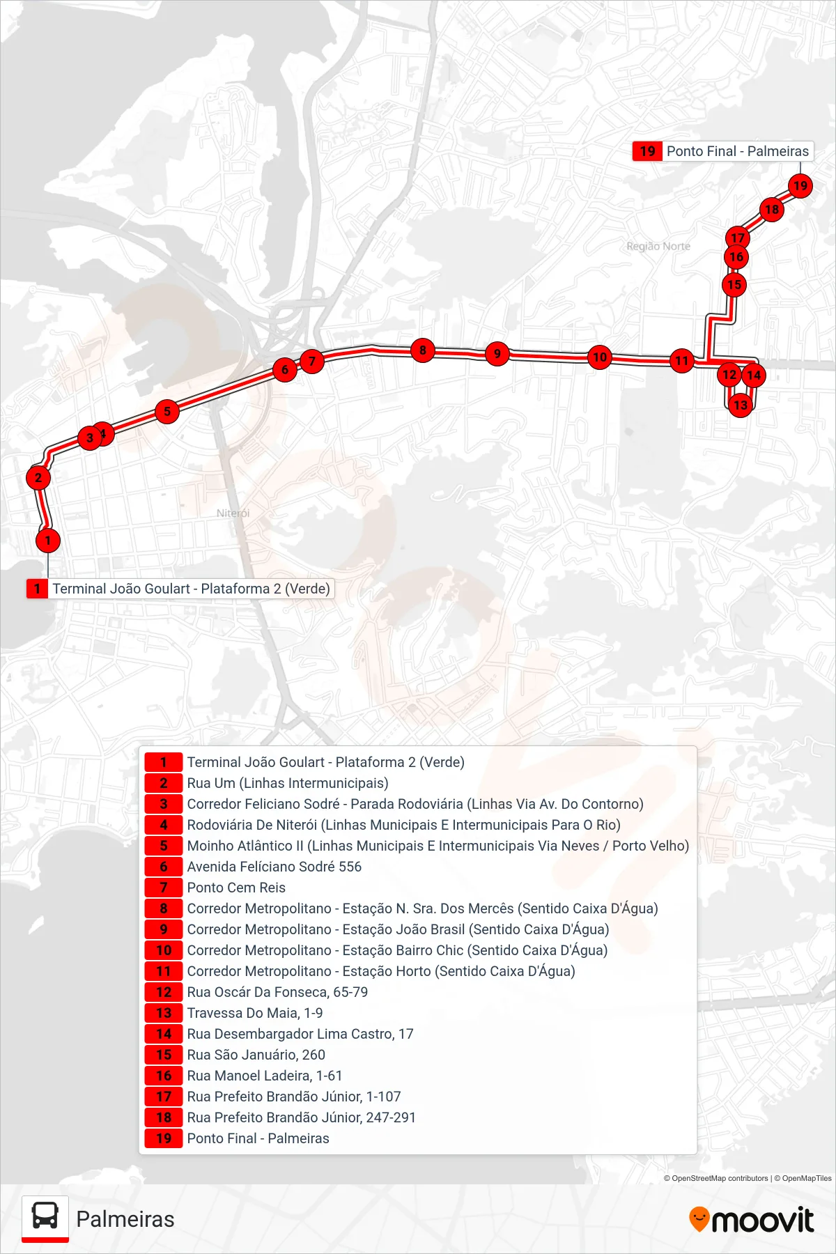
Stops list (24 - Palmeiras)
- Terminal João Goulart - Plataforma 2 (Verde)
- Rua Um (Linhas Intermunicipais)
- Corredor Feliciano Sodré - Parada Rodoviária (Linhas Via Av. Do Contorno)
- Rodoviária De Niterói (Linhas Municipais E Intermunicipais Para O Rio)
- Moinho Atlântico II (Linhas Municipais E Intermunicipais Via Neves / Porto Velho)
- Avenida Felíciano Sodré 556
- Ponto Cem Reis
- Corredor Metropolitano - Estação N. Sra. Dos Mercês (Sentido Caixa D'Água)
- Corredor Metropolitano - Estação João Brasil (Sentido Caixa D'Água)
- Corredor Metropolitano - Estação Bairro Chic (Sentido Caixa D'Água)
- Corredor Metropolitano - Estação Horto (Sentido Caixa D'Água)
- Rua Oscár Da Fonseca, 65-79
- Travessa Do Maia, 1-9
- Rua Desembargador Lima Castro, 17
- Rua São Januário, 260
- Rua Manoel Ladeira, 1-61
- Rua Prefeito Brandão Júnior, 1-107
- Rua Prefeito Brandão Júnior, 247-291
- Ponto Final - Palmeiras