
24 Bus Route Map
View the 24 route map and see all 24 stops along the route. The map of 24 shows where the bus travels and the location of each stop, making it easy to understand the entire route at a glance.
Explore Sonoma County Transit routes on the map and see where Sonoma County Transit bus services operate. Use the 24 map to find bus stops and see how the 24 connects different areas along its trip.
All 24 stops on the map are displayed in route order, helping you follow the 24 bus from the first stop to the last.
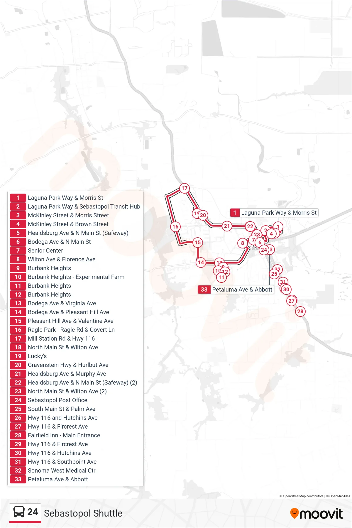
Stops list (24 - Sebastopol Shuttle)
- Laguna Park Way & Morris St
- Laguna Park Way & Sebastopol Transit Hub
- McKinley Street & Morris Street
- McKinley Street & Brown Street
- Healdsburg Ave & N Main St (Safeway)
- Bodega Ave & N Main St
- Senior Center
- Wilton Ave & Florence Ave
- Burbank Heights
- Burbank Heights - Experimental Farm
- Burbank Heights
- Burbank Heights
- Bodega Ave & Virginia Ave
- Bodega Ave & Pleasant Hill Ave
- Pleasant Hill Ave & Valentine Ave
- Ragle Park - Ragle Rd & Covert Ln
- Mill Station Rd & Hwy 116
- North Main St & Wilton Ave
- Lucky's
- Gravenstein Hwy & Hurlbut Ave
- Healdsburg Ave & Murphy Ave
- Healdsburg Ave & N Main St (Safeway) (2)
- North Main St & Wilton Ave (2)
- Sebastopol Post Office
- South Main St & Palm Ave
- Hwy 116 and Hutchins Ave
- Hwy 116 & Fircrest Ave
- Fairfield Inn - Main Entrance
- Hwy 116 & Fircrest Ave
- Hwy 116 & Hutchins Ave
- Hwy 116 & Southpoint Ave
- Sonoma West Medical Ctr
- Petaluma Ave & Abbott