
24 Bus Route Map
View the 24 route map and see all 24 stops along the route. The map of 24 shows where the bus travels and the location of each stop, making it easy to understand the entire route at a glance.
Explore SamTrans routes on the map and see where SamTrans bus services operate. Use the 24 map to find bus stops and see how the 24 connects different areas along its trip.
All 24 stops on the map are displayed in route order, helping you follow the 24 bus from the first stop to the last.
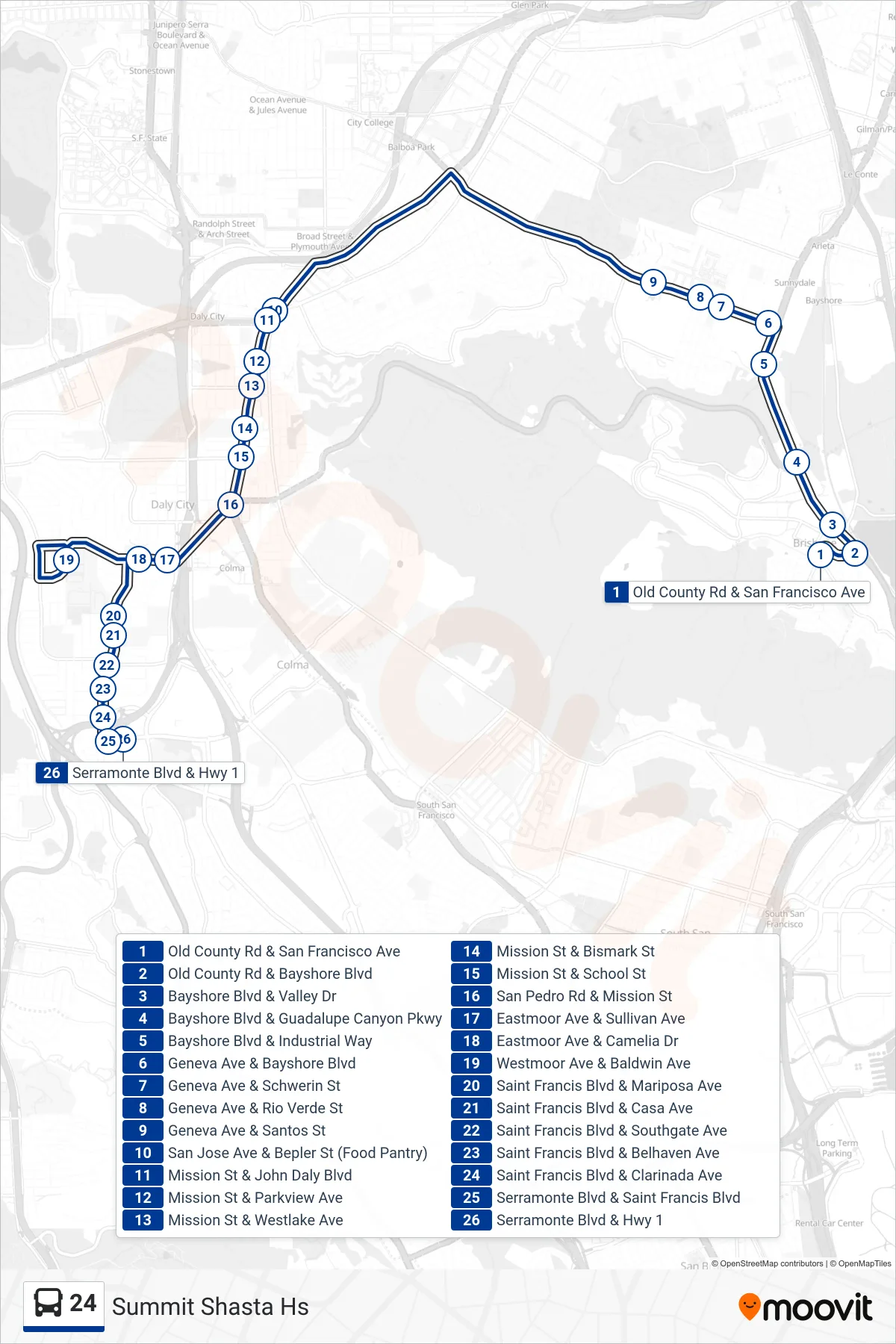
Stops list (24 - Summit Shasta Hs)
- Old County Rd & San Francisco Ave
- Old County Rd & Bayshore Blvd
- Bayshore Blvd & Valley Dr
- Bayshore Blvd & Guadalupe Canyon Pkwy
- Bayshore Blvd & Industrial Way
- Geneva Ave & Bayshore Blvd
- Geneva Ave & Schwerin St
- Geneva Ave & Rio Verde St
- Geneva Ave & Santos St
- San Jose Ave & Bepler St (Food Pantry)
- Mission St & John Daly Blvd
- Mission St & Parkview Ave
- Mission St & Westlake Ave
- Mission St & Bismark St
- Mission St & School St
- San Pedro Rd & Mission St
- Eastmoor Ave & Sullivan Ave
- Eastmoor Ave & Camelia Dr
- Westmoor Ave & Baldwin Ave
- Saint Francis Blvd & Mariposa Ave
- Saint Francis Blvd & Casa Ave
- Saint Francis Blvd & Southgate Ave
- Saint Francis Blvd & Belhaven Ave
- Saint Francis Blvd & Clarinada Ave
- Serramonte Blvd & Saint Francis Blvd
- Serramonte Blvd & Hwy 1