
24 Bus Route Map
View the 24 route map and see all 24 stops along the route. The map of 24 shows where the bus travels and the location of each stop, making it easy to understand the entire route at a glance.
Explore Verkehrsbetriebe Karlsruhe GmbH routes on the map and see where Verkehrsbetriebe Karlsruhe GmbH bus services operate. Use the 24 map to find bus stops and see how the 24 connects different areas along its trip.
All 24 stops on the map are displayed in route order, helping you follow the 24 bus from the first stop to the last.
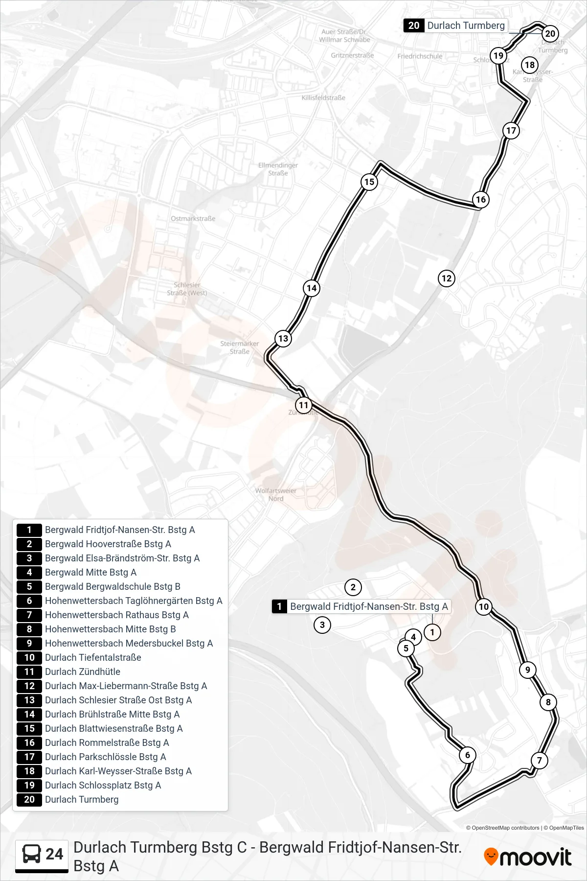
Stops list (24 - Durlach Turmberg)
- Bergwald Fridtjof-Nansen-Str. Bstg A
- Bergwald Hooverstraße Bstg A
- Bergwald Elsa-Brändström-Str. Bstg A
- Bergwald Mitte Bstg A
- Bergwald Bergwaldschule Bstg B
- Hohenwettersbach Taglöhnergärten Bstg A
- Hohenwettersbach Rathaus Bstg A
- Hohenwettersbach Mitte Bstg B
- Hohenwettersbach Medersbuckel Bstg A
- Durlach Tiefentalstraße
- Durlach Zündhütle
- Durlach Max-Liebermann-Straße Bstg A
- Durlach Schlesier Straße Ost Bstg A
- Durlach Brühlstraße Mitte Bstg A
- Durlach Blattwiesenstraße Bstg A
- Durlach Rommelstraße Bstg A
- Durlach Parkschlössle Bstg A
- Durlach Karl-Weysser-Straße Bstg A
- Durlach Schlossplatz Bstg A
- Durlach Turmberg