
24N Bus Route Map
View the 24N route map and see all 24N stops along the route. The map of 24N shows where the bus travels and the location of each stop, making it easy to understand the entire route at a glance.
Explore NT routes on the map and see where NT bus services operate. Use the 24N map to find bus stops and see how the 24N connects different areas along its trip.
All 24N stops on the map are displayed in route order, helping you follow the 24N bus from the first stop to the last.
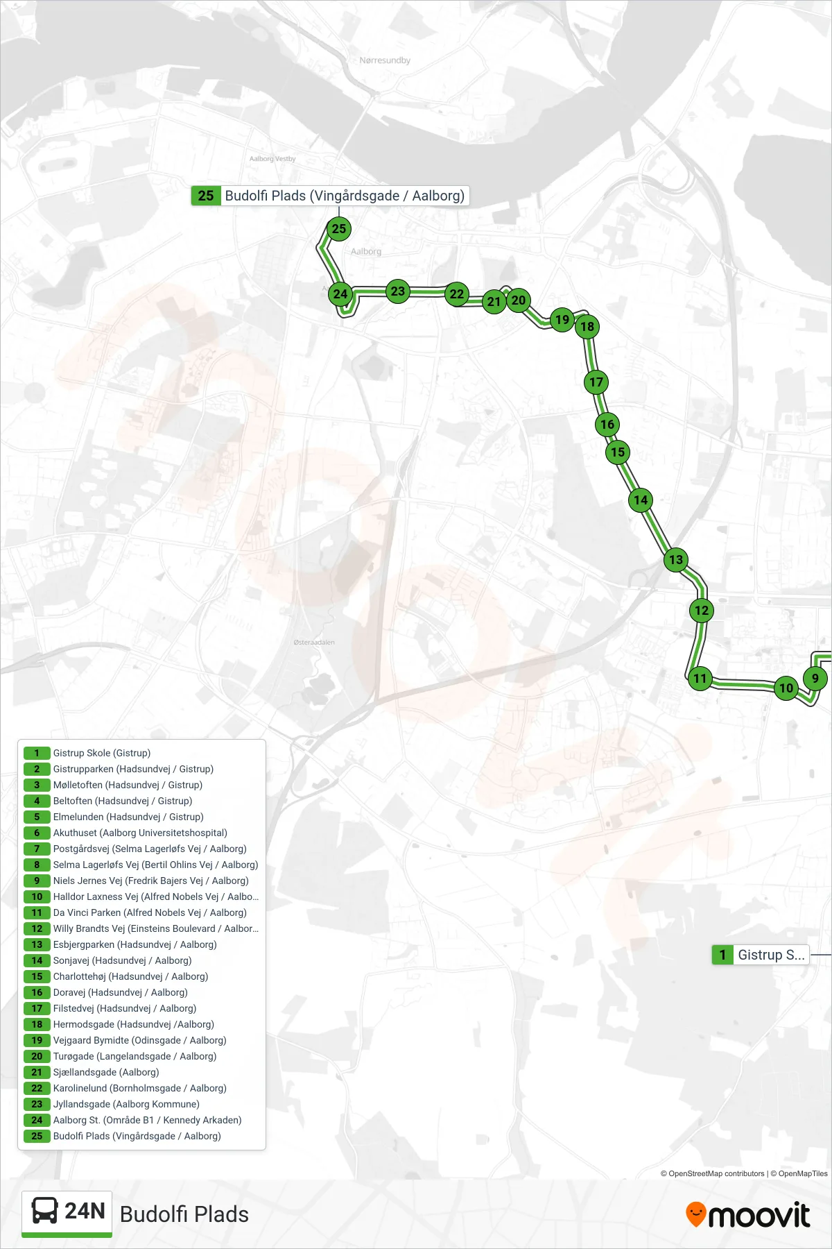
Stops list (24N - Budolfi Plads)
- Gistrup Skole (Gistrup)
- Gistrupparken (Hadsundvej / Gistrup)
- Mølletoften (Hadsundvej / Gistrup)
- Beltoften (Hadsundvej / Gistrup)
- Elmelunden (Hadsundvej / Gistrup)
- Akuthuset (Aalborg Universitetshospital)
- Postgårdsvej (Selma Lagerløfs Vej / Aalborg)
- Selma Lagerløfs Vej (Bertil Ohlins Vej / Aalborg)
- Niels Jernes Vej (Fredrik Bajers Vej / Aalborg)
- Halldor Laxness Vej (Alfred Nobels Vej / Aalborg)
- Da Vinci Parken (Alfred Nobels Vej / Aalborg)
- Willy Brandts Vej (Einsteins Boulevard / Aalborg)
- Esbjergparken (Hadsundvej / Aalborg)
- Sonjavej (Hadsundvej / Aalborg)
- Charlottehøj (Hadsundvej / Aalborg)
- Doravej (Hadsundvej / Aalborg)
- Filstedvej (Hadsundvej / Aalborg)
- Hermodsgade (Hadsundvej /Aalborg)
- Vejgaard Bymidte (Odinsgade / Aalborg)
- Turøgade (Langelandsgade / Aalborg)
- Sjællandsgade (Aalborg)
- Karolinelund (Bornholmsgade / Aalborg)
- Jyllandsgade (Aalborg Kommune)
- Aalborg St. (Område B1 / Kennedy Arkaden)
- Budolfi Plads (Vingårdsgade / Aalborg)