
25 Bus Route Map
View the 25 route map and see all 25 stops along the route. The map of 25 shows where the bus travels and the location of each stop, making it easy to understand the entire route at a glance.
Explore Cottbusverkehr routes on the map and see where Cottbusverkehr bus services operate. Use the 25 map to find bus stops and see how the 25 connects different areas along its trip.
All 25 stops on the map are displayed in route order, helping you follow the 25 bus from the first stop to the last.
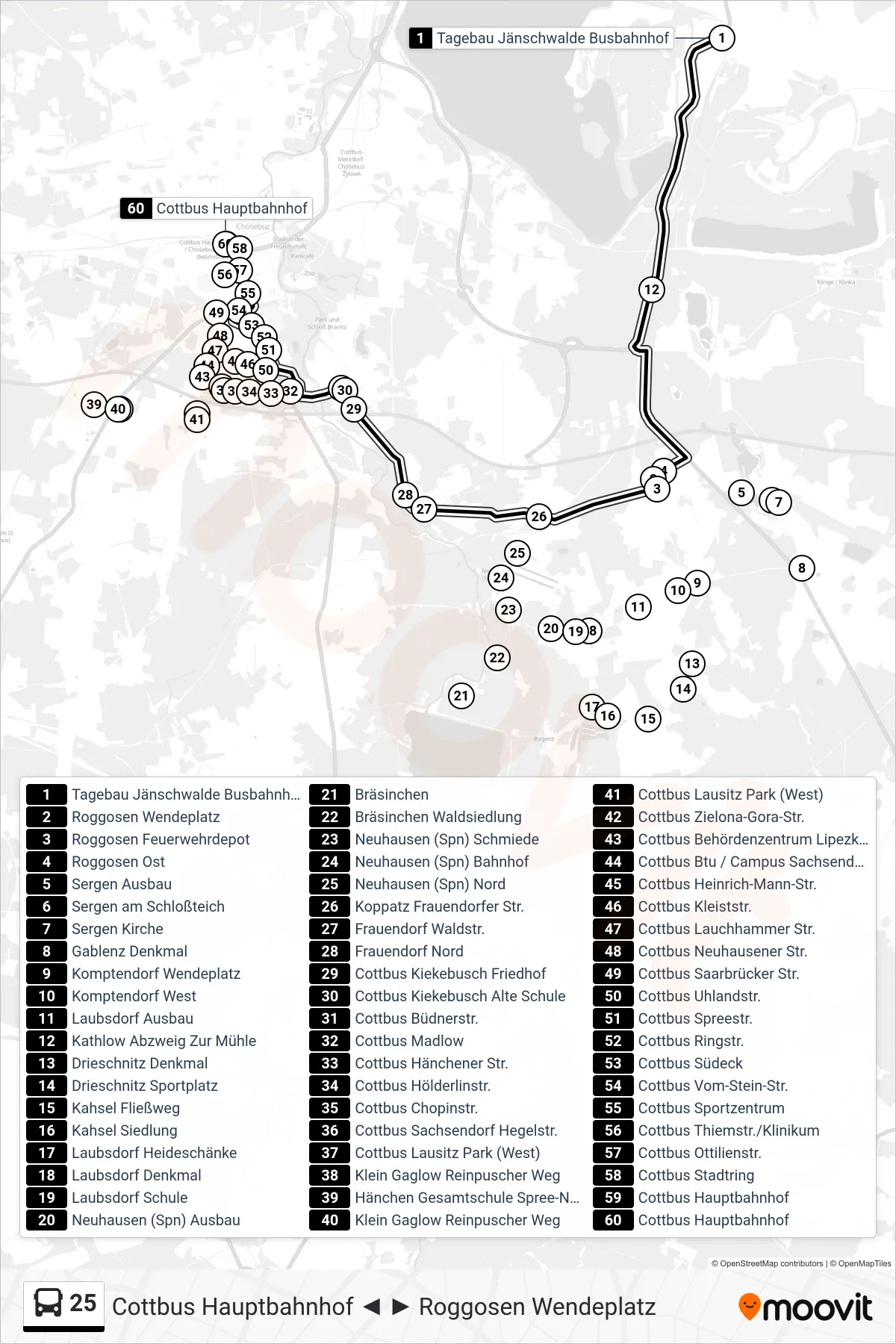
Stops list (25 - Cottbus Hauptbahnhof)
- Tagebau Jänschwalde Busbahnhof
- Roggosen Wendeplatz
- Roggosen Feuerwehrdepot
- Roggosen Ost
- Sergen Ausbau
- Sergen am Schloßteich
- Sergen Kirche
- Gablenz Denkmal
- Komptendorf Wendeplatz
- Komptendorf West
- Laubsdorf Ausbau
- Kathlow Abzweig Zur Mühle
- Drieschnitz Denkmal
- Drieschnitz Sportplatz
- Kahsel Fließweg
- Kahsel Siedlung
- Laubsdorf Heideschänke
- Laubsdorf Denkmal
- Laubsdorf Schule
- Neuhausen (Spn) Ausbau
- Bräsinchen
- Bräsinchen Waldsiedlung
- Neuhausen (Spn) Schmiede
- Neuhausen (Spn) Bahnhof
- Neuhausen (Spn) Nord
- Koppatz Frauendorfer Str.
- Frauendorf Waldstr.
- Frauendorf Nord
- Cottbus Kiekebusch Friedhof
- Cottbus Kiekebusch Alte Schule
- Cottbus Büdnerstr.
- Cottbus Madlow
- Cottbus Hänchener Str.
- Cottbus Hölderlinstr.
- Cottbus Chopinstr.
- Cottbus Sachsendorf Hegelstr.
- Cottbus Lausitz Park (West)
- Klein Gaglow Reinpuscher Weg
- Hänchen Gesamtschule Spree-Neiße
- Klein Gaglow Reinpuscher Weg
- Cottbus Lausitz Park (West)
- Cottbus Zielona-Gora-Str.
- Cottbus Behördenzentrum Lipezker Str.
- Cottbus Btu / Campus Sachsendorf (Ost)
- Cottbus Heinrich-Mann-Str.
- Cottbus Kleiststr.
- Cottbus Lauchhammer Str.
- Cottbus Neuhausener Str.
- Cottbus Saarbrücker Str.
- Cottbus Uhlandstr.
- Cottbus Spreestr.
- Cottbus Ringstr.
- Cottbus Südeck
- Cottbus Vom-Stein-Str.
- Cottbus Sportzentrum
- Cottbus Thiemstr./Klinikum
- Cottbus Ottilienstr.
- Cottbus Stadtring
- Cottbus Hauptbahnhof
- Cottbus Hauptbahnhof