
25 Bus Route Map
View the 25 route map and see all 25 stops along the route. The map of 25 shows where the bus travels and the location of each stop, making it easy to understand the entire route at a glance.
Explore Space Coast Area Transit routes on the map and see where Space Coast Area Transit bus services operate. Use the 25 map to find bus stops and see how the 25 connects different areas along its trip.
All 25 stops on the map are displayed in route order, helping you follow the 25 bus from the first stop to the last.
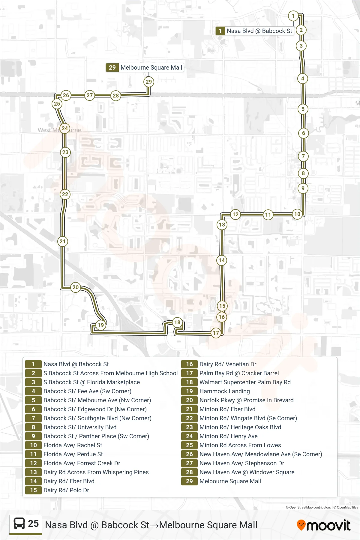
Stops list (25 - Nasa Blvd @ Babcock St→Melbourne Square Mall)
- Nasa Blvd @ Babcock St
- S Babcock St Across From Melbourne High School
- S Babcock St @ Florida Marketplace
- Babcock St/ Fee Ave (Sw Corner)
- Babcock St/ Melbourne Ave (Nw Corner)
- Babcock St/ Edgewood Dr (Nw Corner)
- Babcock St/ Southgate Blvd (Nw Corner)
- Babcock St/ University Blvd
- Babcock St / Panther Place (Sw Corner)
- Florida Ave/ Rachel St
- Florida Ave/ Perdue St
- Florida Ave/ Forrest Creek Dr
- Dairy Rd Across From Whispering Pines
- Dairy Rd/ Eber Blvd
- Dairy Rd/ Polo Dr
- Dairy Rd/ Venetian Dr
- Palm Bay Rd @ Cracker Barrel
- Walmart Supercenter Palm Bay Rd
- Hammock Landing
- Norfolk Pkwy @ Promise In Brevard
- Minton Rd/ Eber Blvd
- Minton Rd/ Wingate Blvd (Se Corner)
- Minton Rd/ Heritage Oaks Blvd
- Minton Rd/ Henry Ave
- Minton Rd Across From Lowes
- New Haven Ave/ Meadowlane Ave (Se Corner)
- New Haven Ave/ Stephenson Dr
- New Haven Ave @ Windover Square
- Melbourne Square Mall