
25 Bus Route Map
View the 25 route map and see all 25 stops along the route. The map of 25 shows where the bus travels and the location of each stop, making it easy to understand the entire route at a glance.
Explore Niederrheinische VKB routes on the map and see where Niederrheinische VKB bus services operate. Use the 25 map to find bus stops and see how the 25 connects different areas along its trip.
All 25 stops on the map are displayed in route order, helping you follow the 25 bus from the first stop to the last.
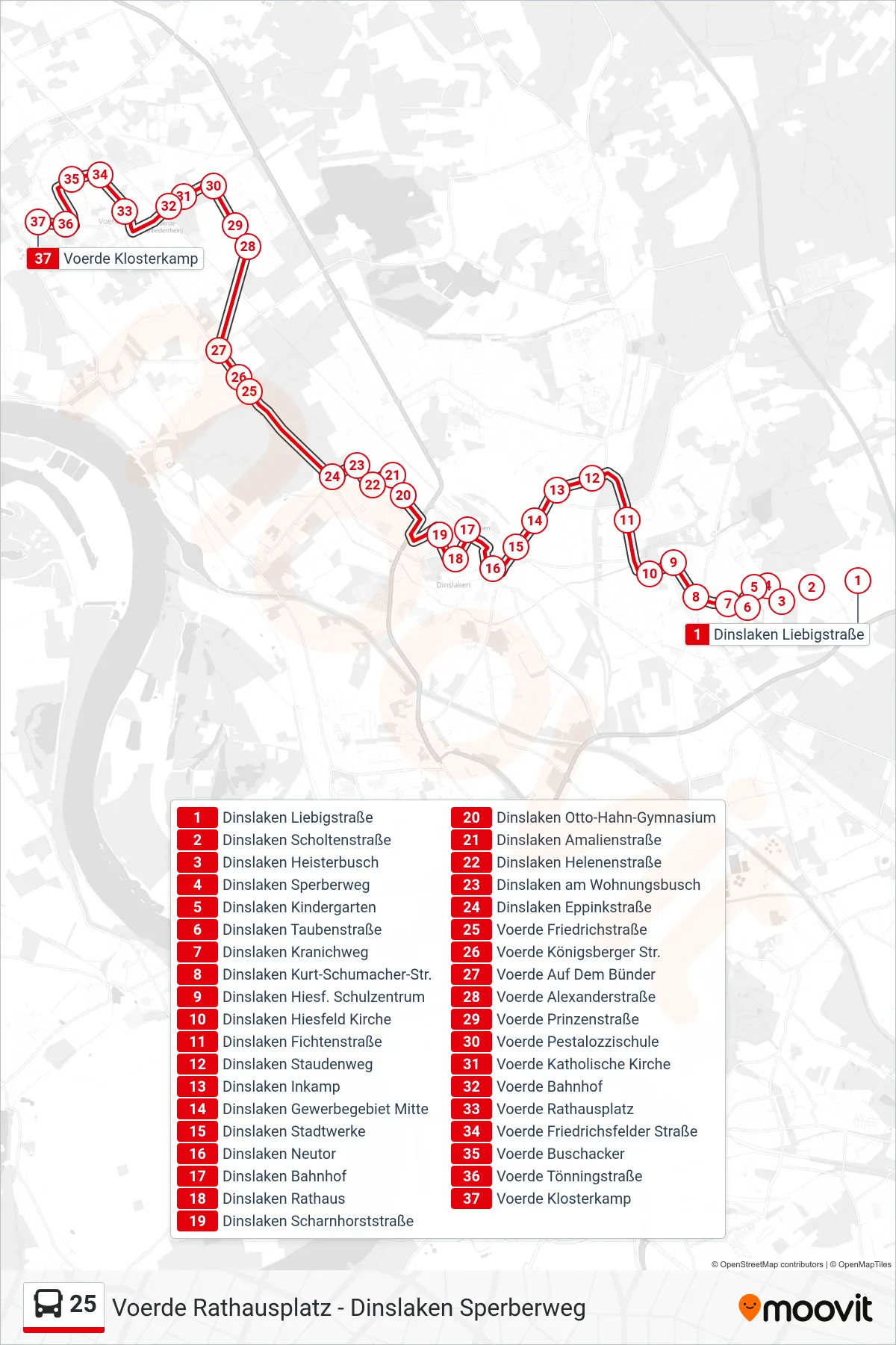
Stops list (25 - Voerde Klosterkamp)
- Dinslaken Liebigstraße
- Dinslaken Scholtenstraße
- Dinslaken Heisterbusch
- Dinslaken Sperberweg
- Dinslaken Kindergarten
- Dinslaken Taubenstraße
- Dinslaken Kranichweg
- Dinslaken Kurt-Schumacher-Str.
- Dinslaken Hiesf. Schulzentrum
- Dinslaken Hiesfeld Kirche
- Dinslaken Fichtenstraße
- Dinslaken Staudenweg
- Dinslaken Inkamp
- Dinslaken Gewerbegebiet Mitte
- Dinslaken Stadtwerke
- Dinslaken Neutor
- Dinslaken Bahnhof
- Dinslaken Rathaus
- Dinslaken Scharnhorststraße
- Dinslaken Otto-Hahn-Gymnasium
- Dinslaken Amalienstraße
- Dinslaken Helenenstraße
- Dinslaken am Wohnungsbusch
- Dinslaken Eppinkstraße
- Voerde Friedrichstraße
- Voerde Königsberger Str.
- Voerde Auf Dem Bünder
- Voerde Alexanderstraße
- Voerde Prinzenstraße
- Voerde Pestalozzischule
- Voerde Katholische Kirche
- Voerde Bahnhof
- Voerde Rathausplatz
- Voerde Friedrichsfelder Straße
- Voerde Buschacker
- Voerde Tönningstraße
- Voerde Klosterkamp
Change direction
- Route Map - 25 - Voerde Rathausplatz
- Route Map - 25 - Voerde Schulzentrum Nord
- Route Map - 25 - Dinslaken Bahnhof
- Route Map - 25 - Dinslaken Sperberweg
- Route Map - 25 - Dinslaken Bahnhof
- Route Map - 25 - Voerde Bülowstraße
- Route Map - 25 - Voerde Alexanderstraße
- Route Map - 25 - Dinslaken Liebigstraße
- Route Map - 25 - Voerde Friedrichstraße