
250 Bus Route Map
View the 250 route map and see all 250 stops along the route. The map of 250 shows where the bus travels and the location of each stop, making it easy to understand the entire route at a glance.
Explore SamTrans routes on the map and see where SamTrans bus services operate. Use the 250 map to find bus stops and see how the 250 connects different areas along its trip.
All 250 stops on the map are displayed in route order, helping you follow the 250 bus from the first stop to the last.
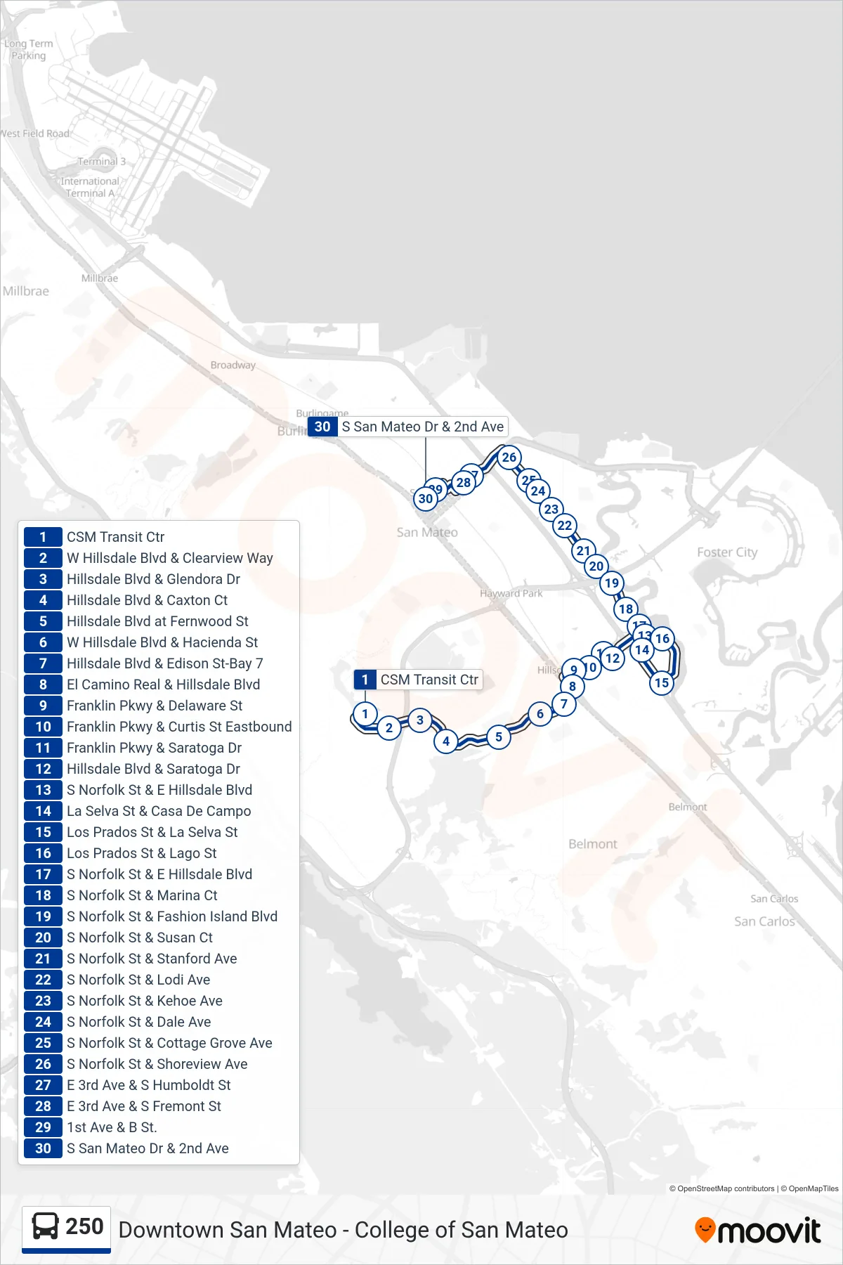
Stops list (250 - Downtown San Mateo)
- CSM Transit Ctr
- W Hillsdale Blvd & Clearview Way
- Hillsdale Blvd & Glendora Dr
- Hillsdale Blvd & Caxton Ct
- Hillsdale Blvd at Fernwood St
- W Hillsdale Blvd & Hacienda St
- Hillsdale Blvd & Edison St-Bay 7
- El Camino Real & Hillsdale Blvd
- Franklin Pkwy & Delaware St
- Franklin Pkwy & Curtis St Eastbound
- Franklin Pkwy & Saratoga Dr
- Hillsdale Blvd & Saratoga Dr
- S Norfolk St & E Hillsdale Blvd
- La Selva St & Casa De Campo
- Los Prados St & La Selva St
- Los Prados St & Lago St
- S Norfolk St & E Hillsdale Blvd
- S Norfolk St & Marina Ct
- S Norfolk St & Fashion Island Blvd
- S Norfolk St & Susan Ct
- S Norfolk St & Stanford Ave
- S Norfolk St & Lodi Ave
- S Norfolk St & Kehoe Ave
- S Norfolk St & Dale Ave
- S Norfolk St & Cottage Grove Ave
- S Norfolk St & Shoreview Ave
- E 3rd Ave & S Humboldt St
- E 3rd Ave & S Fremont St
- 1st Ave & B St.
- S San Mateo Dr & 2nd Ave