
25S Bus Route Map
View the 25S route map and see all 25S stops along the route. The map of 25S shows where the bus travels and the location of each stop, making it easy to understand the entire route at a glance.
Explore Adriabus S.p.A. routes on the map and see where Adriabus S.p.A. bus services operate. Use the 25S map to find bus stops and see how the 25S connects different areas along its trip.
All 25S stops on the map are displayed in route order, helping you follow the 25S bus from the first stop to the last.
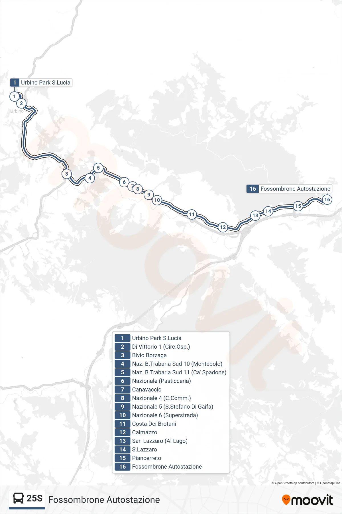
Stops list (25S - Fossombrone Bus Station)
- Urbino Park S.Lucia
- Di Vittorio 1 (Hospital Circuit)
- Borzaga Junction
- National B.Trabaria South 10 (Montepolo)
- National Road B.Trabaria South 11 (Ca' Spadone)
- National Road (Pastry Shop)
- Canavaccio
- Nazionale 4 (Shopping Center)
- National Road 5 (San Stefano Di Gaifa)
- National Road 6 (Highway)
- Costa Dei Brotani
- Calmazzo
- San Lazzaro (At the Lake)
- San Lazzaro
- Piancerreto
- Fossombrone Bus Station
Change direction
- Route Map - 25S - Calcinelli
- Route Map - 25S - Calcinelli (Industrial Zone)
- Route Map - 25S - Fano Station
- Route Map - 25S - Fossombrone Schools (Bay A)
- Route Map - 25S - Calcinelli (School)
- Route Map - 25S - Neruda Park (Bay F)
- Route Map - 25S - Urbino Borgo Mercatale
- Route Map - 25S - Urbino Park S.Lucia
- Route Map - 25S - Fossombrone Bus Station
- Route Map - 25S - Tavernelle 1 (API Station)
- Route Map - 25S - Fossombrone Schools (Bay A)
- Route Map - 25S - Tavernelle
- Route Map - 25S - Trees Bridge
- Route Map - 25S - Fano Pincio
- Route Map - 25S - Calcinelli
- Route Map - 25S - Calmazzo
- Route Map - 25S - Flaminia 7 (Cuccurano Fornace)