
265 Bus Route Map
View the 265 route map and see all 265 stops along the route. The map of 265 shows where the bus travels and the location of each stop, making it easy to understand the entire route at a glance.
Explore DB Regio Bus Mitte routes on the map and see where DB Regio Bus Mitte bus services operate. Use the 265 map to find bus stops and see how the 265 connects different areas along its trip.
All 265 stops on the map are displayed in route order, helping you follow the 265 bus from the first stop to the last.
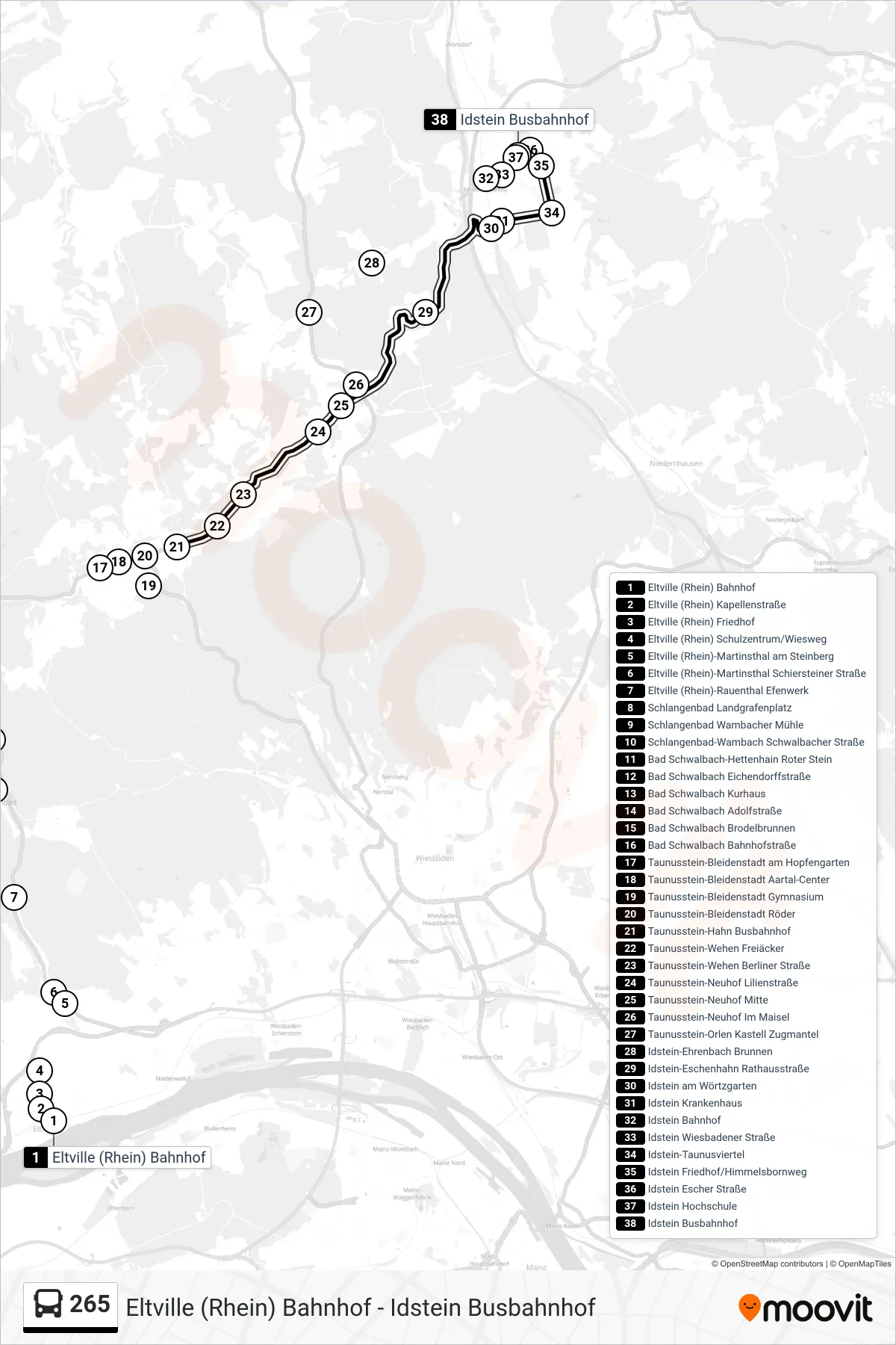
Stops list (265 - Idstein Busbahnhof)
- Eltville (Rhein) Bahnhof
- Eltville (Rhein) Kapellenstraße
- Eltville (Rhein) Friedhof
- Eltville (Rhein) Schulzentrum/Wiesweg
- Eltville (Rhein)-Martinsthal am Steinberg
- Eltville (Rhein)-Martinsthal Schiersteiner Straße
- Eltville (Rhein)-Rauenthal Efenwerk
- Schlangenbad Landgrafenplatz
- Schlangenbad Wambacher Mühle
- Schlangenbad-Wambach Schwalbacher Straße
- Bad Schwalbach-Hettenhain Roter Stein
- Bad Schwalbach Eichendorffstraße
- Bad Schwalbach Kurhaus
- Bad Schwalbach Adolfstraße
- Bad Schwalbach Brodelbrunnen
- Bad Schwalbach Bahnhofstraße
- Taunusstein-Bleidenstadt am Hopfengarten
- Taunusstein-Bleidenstadt Aartal-Center
- Taunusstein-Bleidenstadt Gymnasium
- Taunusstein-Bleidenstadt Röder
- Taunusstein-Hahn Busbahnhof
- Taunusstein-Wehen Freiäcker
- Taunusstein-Wehen Berliner Straße
- Taunusstein-Neuhof Lilienstraße
- Taunusstein-Neuhof Mitte
- Taunusstein-Neuhof Im Maisel
- Taunusstein-Orlen Kastell Zugmantel
- Idstein-Ehrenbach Brunnen
- Idstein-Eschenhahn Rathausstraße
- Idstein am Wörtzgarten
- Idstein Krankenhaus
- Idstein Bahnhof
- Idstein Wiesbadener Straße
- Idstein-Taunusviertel
- Idstein Friedhof/Himmelsbornweg
- Idstein Escher Straße
- Idstein Hochschule
- Idstein Busbahnhof