
268S Bus Route Map
View the 268S route map and see all 268S stops along the route. The map of 268S shows where the bus travels and the location of each stop, making it easy to understand the entire route at a glance.
Explore SWEG Südwestdeutsche Landesverkehrs-AG routes on the map and see where SWEG Südwestdeutsche Landesverkehrs-AG bus services operate. Use the 268S map to find bus stops and see how the 268S connects different areas along its trip.
All 268S stops on the map are displayed in route order, helping you follow the 268S bus from the first stop to the last.
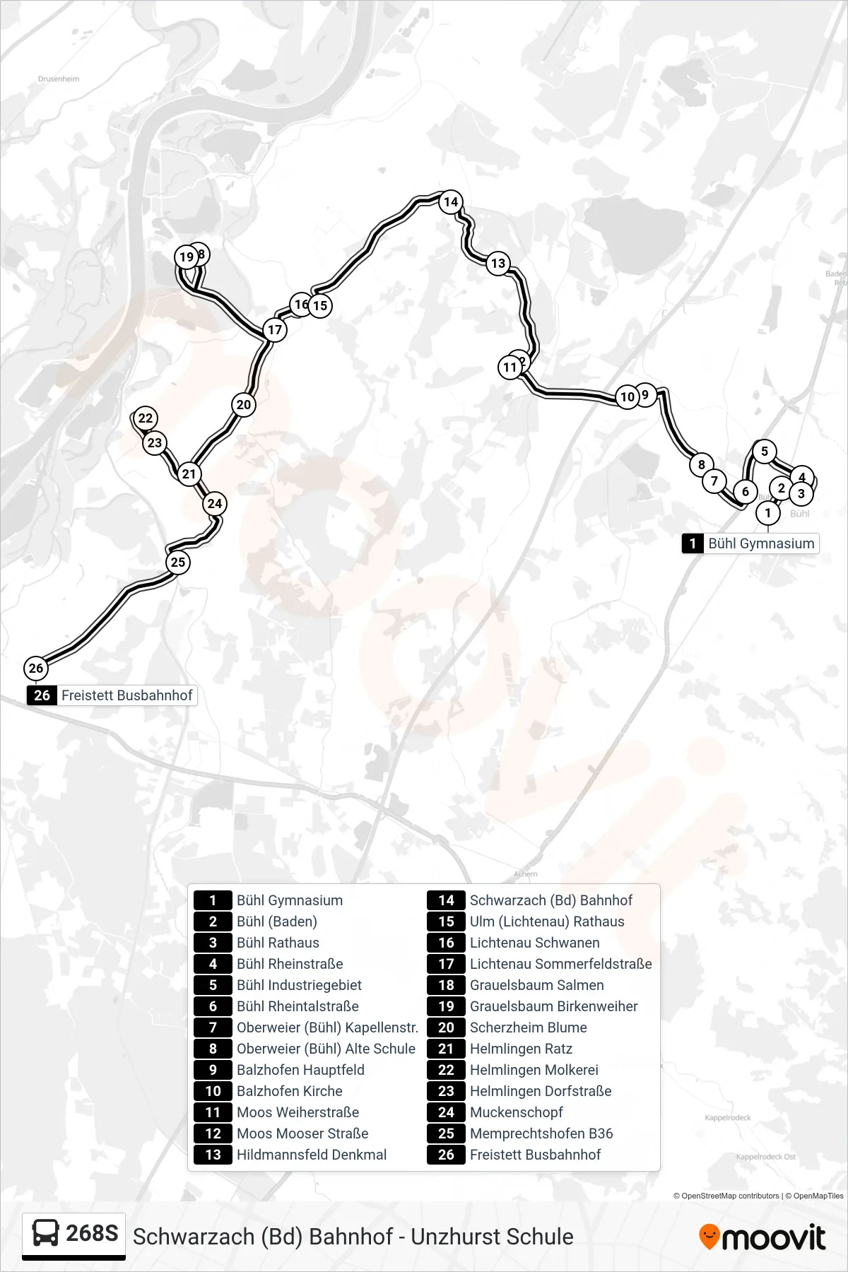
Stops list (268S - Freistett Busbahnhof)
- Bühl Gymnasium
- Bühl (Baden)
- Bühl Rathaus
- Bühl Rheinstraße
- Bühl Industriegebiet
- Bühl Rheintalstraße
- Oberweier (Bühl) Kapellenstr.
- Oberweier (Bühl) Alte Schule
- Balzhofen Hauptfeld
- Balzhofen Kirche
- Moos Weiherstraße
- Moos Mooser Straße
- Hildmannsfeld Denkmal
- Schwarzach (Bd) Bahnhof
- Ulm (Lichtenau) Rathaus
- Lichtenau Schwanen
- Lichtenau Sommerfeldstraße
- Grauelsbaum Salmen
- Grauelsbaum Birkenweiher
- Scherzheim Blume
- Helmlingen Ratz
- Helmlingen Molkerei
- Helmlingen Dorfstraße
- Muckenschopf
- Memprechtshofen B36
- Freistett Busbahnhof
Change direction
- Route Map - 268S - Bühl (Baden)
- Route Map - 268S - Oberweier (Bühl) Kapellenstr.
- Route Map - 268S - Schwarzach (Bd) Bahnhof
- Route Map - 268S - Vimbuch Tullaschule
- Route Map - 268S - Söllingen Kirche
- Route Map - 268S - Oberbruch Rathaus
- Route Map - 268S - Lichtenau Sommerfeldstraße
- Route Map - 268S - Bühl Gymnasium
- Route Map - 268S - Muckenschopf
- Route Map - 268S - Unzhurst Schule
- Route Map - 268S - Schwarzach (Bd) Bahnhof
- Route Map - 268S - Lichtenau Schule