
269 Bus Route Map
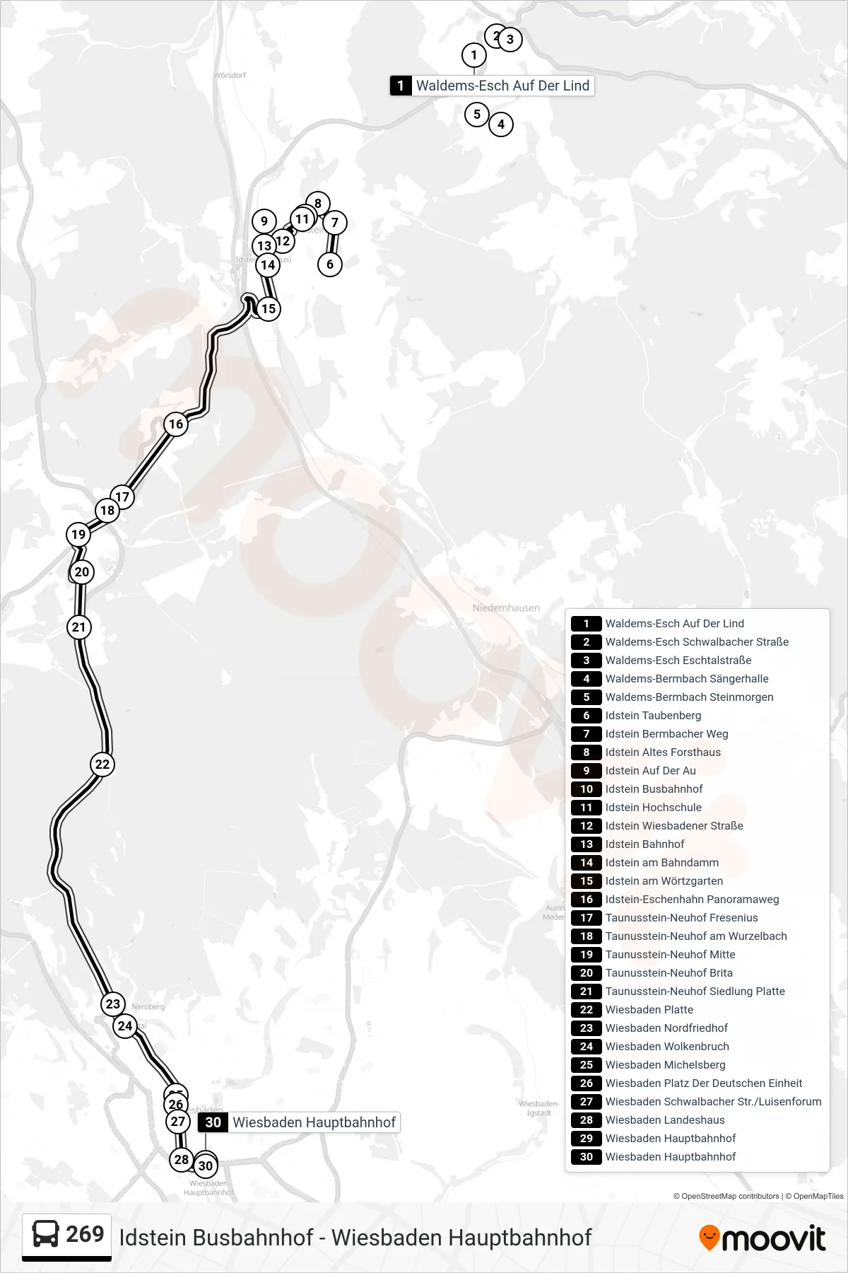
View the 269 route map and see all 269 stops along the route. The map of 269 shows where the bus travels and the location of each stop, making it easy to understand the entire route at a glance.
Explore WEFRA-Bus GbR routes on the map and see where WEFRA-Bus GbR bus services operate. Use the 269 map to find bus stops and see how the 269 connects different areas along its trip.
All 269 stops on the map are displayed in route order, helping you follow the 269 bus from the first stop to the last.
Stops list (269 - Wiesbaden Hauptbahnhof)
- Waldems-Esch Auf Der Lind
- Waldems-Esch Schwalbacher Straße
- Waldems-Esch Eschtalstraße
- Waldems-Bermbach Sängerhalle
- Waldems-Bermbach Steinmorgen
- Idstein Taubenberg
- Idstein Bermbacher Weg
- Idstein Altes Forsthaus
- Idstein Auf Der Au
- Idstein Busbahnhof
- Idstein Hochschule
- Idstein Wiesbadener Straße
- Idstein Bahnhof
- Idstein am Bahndamm
- Idstein am Wörtzgarten
- Idstein-Eschenhahn Panoramaweg
- Taunusstein-Neuhof Fresenius
- Taunusstein-Neuhof am Wurzelbach
- Taunusstein-Neuhof Mitte
- Taunusstein-Neuhof Brita
- Taunusstein-Neuhof Siedlung Platte
- Wiesbaden Platte
- Wiesbaden Nordfriedhof
- Wiesbaden Wolkenbruch
- Wiesbaden Michelsberg
- Wiesbaden Platz Der Deutschen Einheit
- Wiesbaden Schwalbacher Str./Luisenforum
- Wiesbaden Landeshaus
- Wiesbaden Hauptbahnhof
- Wiesbaden Hauptbahnhof
Change direction
- Route Map - 269 - Taunusstein-Neuhof Mitte
- Route Map - 269 - Taunusstein-Neuhof Siedlung Platte
- Route Map - 269 - Idstein Auf Der Au
- Route Map - 269 - Niedernhausen-Oberseelbach am Eichwald
- Route Map - 269 - Idstein Hochschule
- Route Map - 269 - Idstein Taubenberg
- Route Map - 269 - Waldems-Esch Auf Der Lind
- Route Map - 269 - Idstein Busbahnhof
- Route Map - 269 - Wiesbaden Berufsschulzentrum