
27 Cable Car Route Map
View the 27 route map and see all 27 stops along the route. The map of 27 shows where the cable car travels and the location of each stop, making it easy to understand the entire route at a glance.
Explore KP Kyivpastrans routes on the map and see where KP Kyivpastrans cable car services operate. Use the 27 map to find cable car stations and see how the 27 connects different areas along its trip.
All 27 stops on the map are displayed in route order, helping you follow the 27 cable car from the first station to the last.
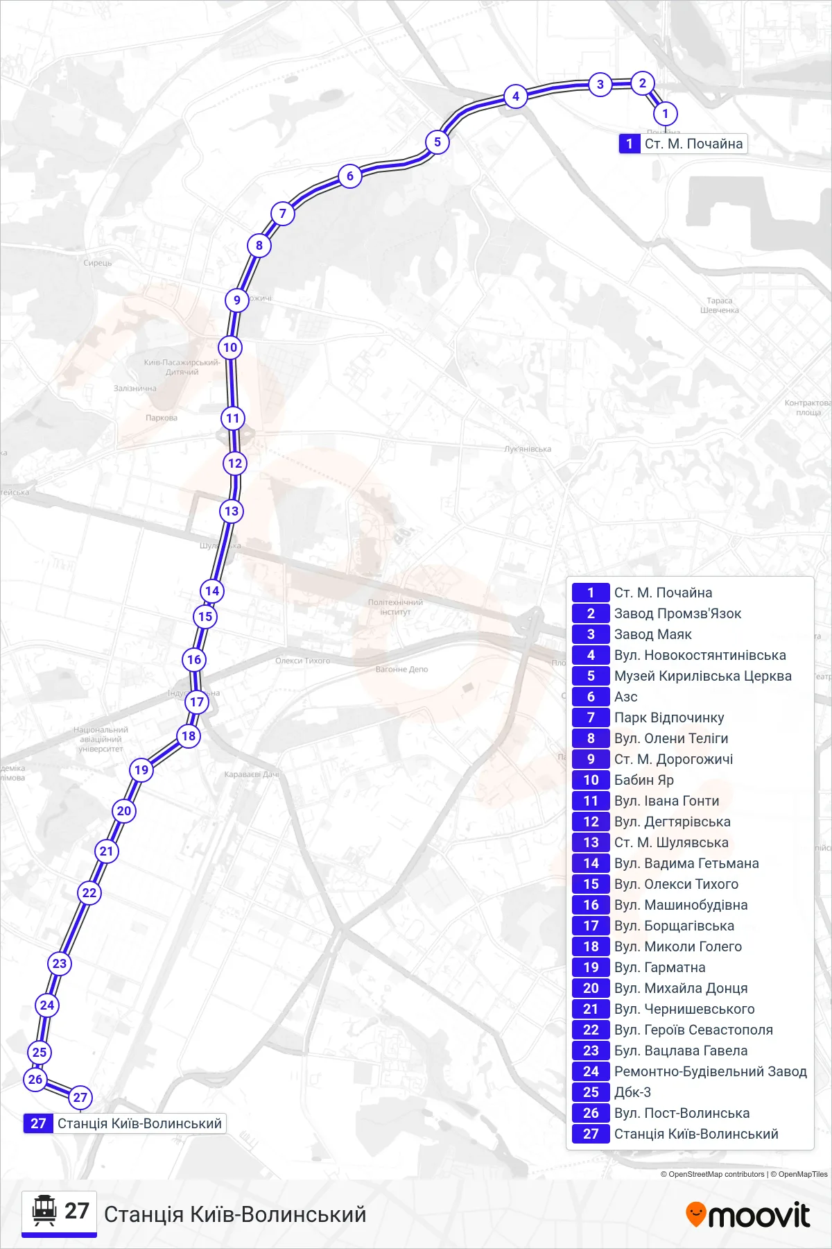
Stops list (27 - Kyiv-Volynsky Station)
- Metro Station Pochayna
- Promzvyazok Factory
- Mayak Factory
- Novokostiantynivska St.
- Kyrylivska Church Museum
- Gas Station
- Rest Park
- Oleny Telihy Street
- Dorohozhychi Metro Station
- Babyn Yar
- Ivan Honty Street
- Dehtiarska Street
- Shuliavska Metro Station
- Vadym Hetman Street
- Oleksy Tykhoho Street
- Mashynobudivna Street
- Borshchahivska St
- Mykola Holoho Street
- Harmatna Street
- Mykhaila Dontsya Street
- Chernyshevsky Street
- Heroes of Sevastopol Street
- Vaclav Havel Boulevard
- Repair and Construction Plant
- DBK-3
- Post-Volynska Street
- Kyiv-Volynsky Station