
270 Bus Route Map
View the 270 route map and see all 270 stops along the route. The map of 270 shows where the bus travels and the location of each stop, making it easy to understand the entire route at a glance.
Explore PACE routes on the map and see where PACE bus services operate. Use the 270 map to find bus stops and see how the 270 connects different areas along its trip.
All 270 stops on the map are displayed in route order, helping you follow the 270 bus from the first stop to the last.
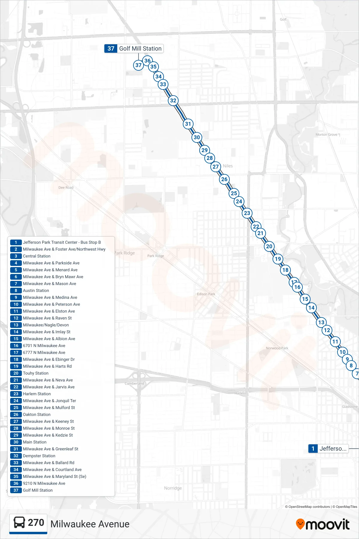
Stops list (270 - Golf Mill Station)
- Jefferson Park Transit Center - Bus Stop B
- Milwaukee Ave & Foster Ave/Northwest Hwy
- Central Station
- Milwaukee Ave & Parkside Ave
- Milwaukee Ave & Menard Ave
- Milwaukee Ave & Bryn Mawr Ave
- Milwaukee Ave & Mason Ave
- Austin Station
- Milwaukee Ave & Medina Ave
- Milwaukee Ave & Peterson Ave
- Milwaukee Ave & Elston Ave
- Milwaukee Ave & Raven St
- Milwaukee/Nagle/Devon
- Milwaukee Ave & Imlay St
- Milwaukee Ave & Albion Ave
- 6701 N Milwaukee Ave
- 6777 N Milwaukee Ave
- Milwaukee Ave & Ebinger Dr
- Milwaukee Ave & Harts Rd
- Touhy Station
- Milwaukee Ave & Neva Ave
- Milwaukee Ave & Jarvis Ave
- Harlem Station
- Milwaukee Ave & Jonquil Ter
- Milwaukee Ave & Mulford St
- Oakton Station
- Milwaukee Ave & Keeney St
- Milwaukee Ave & Monroe St
- Milwaukee Ave & Kedzie St
- Main Station
- Milwaukee Ave & Greenleaf St
- Dempster Station
- Milwaukee Ave & Ballard Rd
- Milwaukee Ave & Courtland Ave
- Milwaukee Ave & Maryland St (Se)
- 9210 N Milwaukee Ave
- Golf Mill Station