
274 Bus Route Map
View the 274 route map and see all 274 stops along the route. The map of 274 shows where the bus travels and the location of each stop, making it easy to understand the entire route at a glance.
Explore DB Regio Bus Mitte routes on the map and see where DB Regio Bus Mitte bus services operate. Use the 274 map to find bus stops and see how the 274 connects different areas along its trip.
All 274 stops on the map are displayed in route order, helping you follow the 274 bus from the first stop to the last.
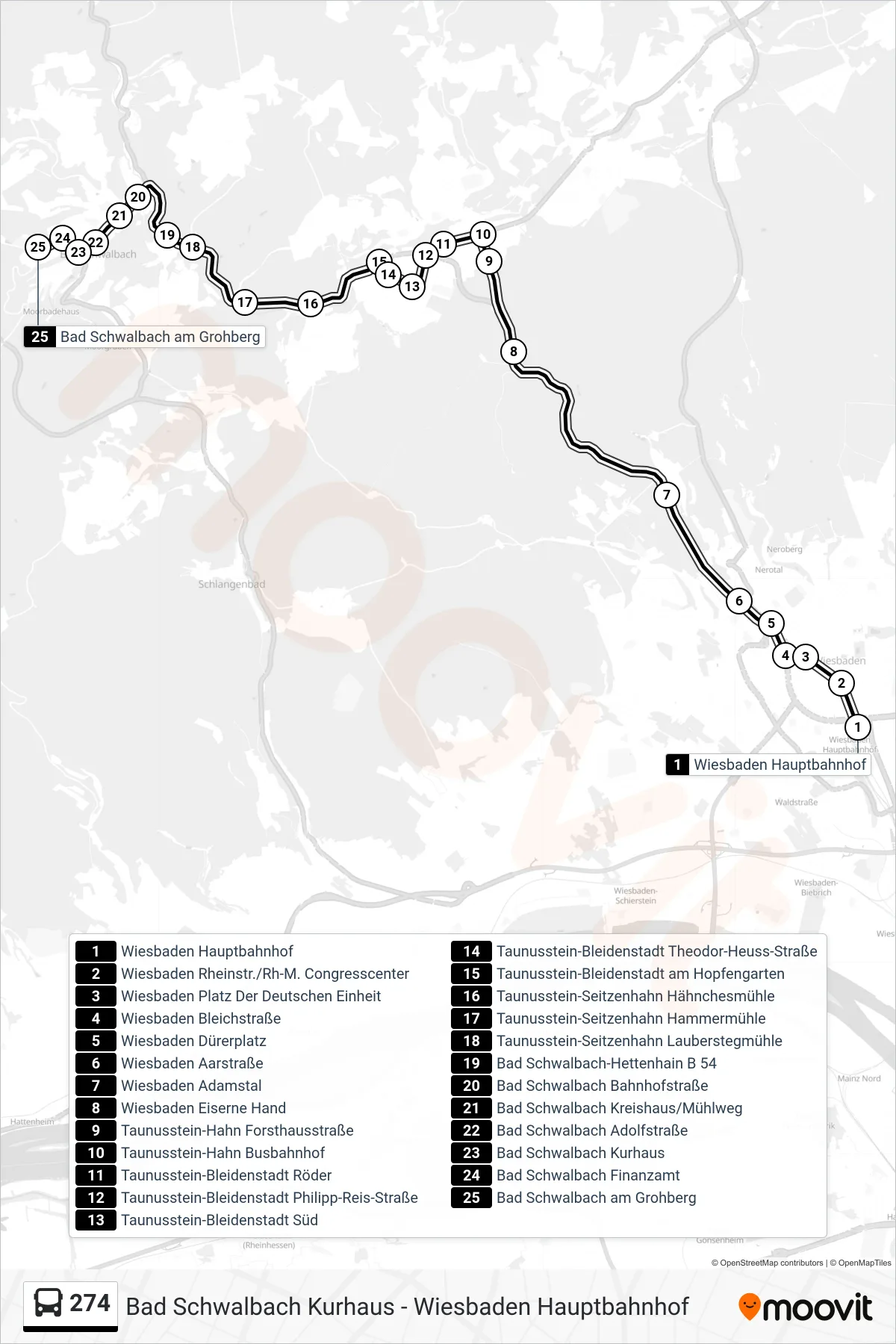
Stops list (274 - Bad Schwalbach am Grohberg)
- Wiesbaden Hauptbahnhof
- Wiesbaden Rheinstr./Rh-M. Congresscenter
- Wiesbaden Platz Der Deutschen Einheit
- Wiesbaden Bleichstraße
- Wiesbaden Dürerplatz
- Wiesbaden Aarstraße
- Wiesbaden Adamstal
- Wiesbaden Eiserne Hand
- Taunusstein-Hahn Forsthausstraße
- Taunusstein-Hahn Busbahnhof
- Taunusstein-Bleidenstadt Röder
- Taunusstein-Bleidenstadt Philipp-Reis-Straße
- Taunusstein-Bleidenstadt Süd
- Taunusstein-Bleidenstadt Theodor-Heuss-Straße
- Taunusstein-Bleidenstadt am Hopfengarten
- Taunusstein-Seitzenhahn Hähnchesmühle
- Taunusstein-Seitzenhahn Hammermühle
- Taunusstein-Seitzenhahn Lauberstegmühle
- Bad Schwalbach-Hettenhain B 54
- Bad Schwalbach Bahnhofstraße
- Bad Schwalbach Kreishaus/Mühlweg
- Bad Schwalbach Adolfstraße
- Bad Schwalbach Kurhaus
- Bad Schwalbach Finanzamt
- Bad Schwalbach am Grohberg
Change direction
- Route Map - 274 - Bad Schwalbach Nao-Schule
- Route Map - 274 - Taunusstein-Bleidenstadt Theodor-Heuss-Straße
- Route Map - 274 - Taunusstein-Hahn Schulzentrum
- Route Map - 274 - Taunusstein-Bleidenstadt Philipp-Reis-Straße
- Route Map - 274 - Taunusstein-Hahn Busbahnhof
- Route Map - 274 - Bad Schwalbach Kurhaus
- Route Map - 274 - Bad Schwalbach Gewerbepark Emser Straße
- Route Map - 274 - Heidenrod-Kemel Ehemalige Taunus Kaserne
- Route Map - 274 - Bad Schwalbach-Hettenhain Gehrenweg
- Route Map - 274 - Bad Schwalbach Kurhaus
- Route Map - 274 - Taunusstein-Hahn Busbahnhof
- Route Map - 274 - Wiesbaden Berufsschulzentrum
- Route Map - 274 - Wiesbaden Hauptbahnhof
- Route Map - 274 - Taunusstein-Bleidenstadt Aartal-Center