
275 Bus Route Map
View the 275 route map and see all 275 stops along the route. The map of 275 shows where the bus travels and the location of each stop, making it easy to understand the entire route at a glance.
Explore Arnold Engelhardt GmbH routes on the map and see where Arnold Engelhardt GmbH bus services operate. Use the 275 map to find bus stops and see how the 275 connects different areas along its trip.
All 275 stops on the map are displayed in route order, helping you follow the 275 bus from the first stop to the last.
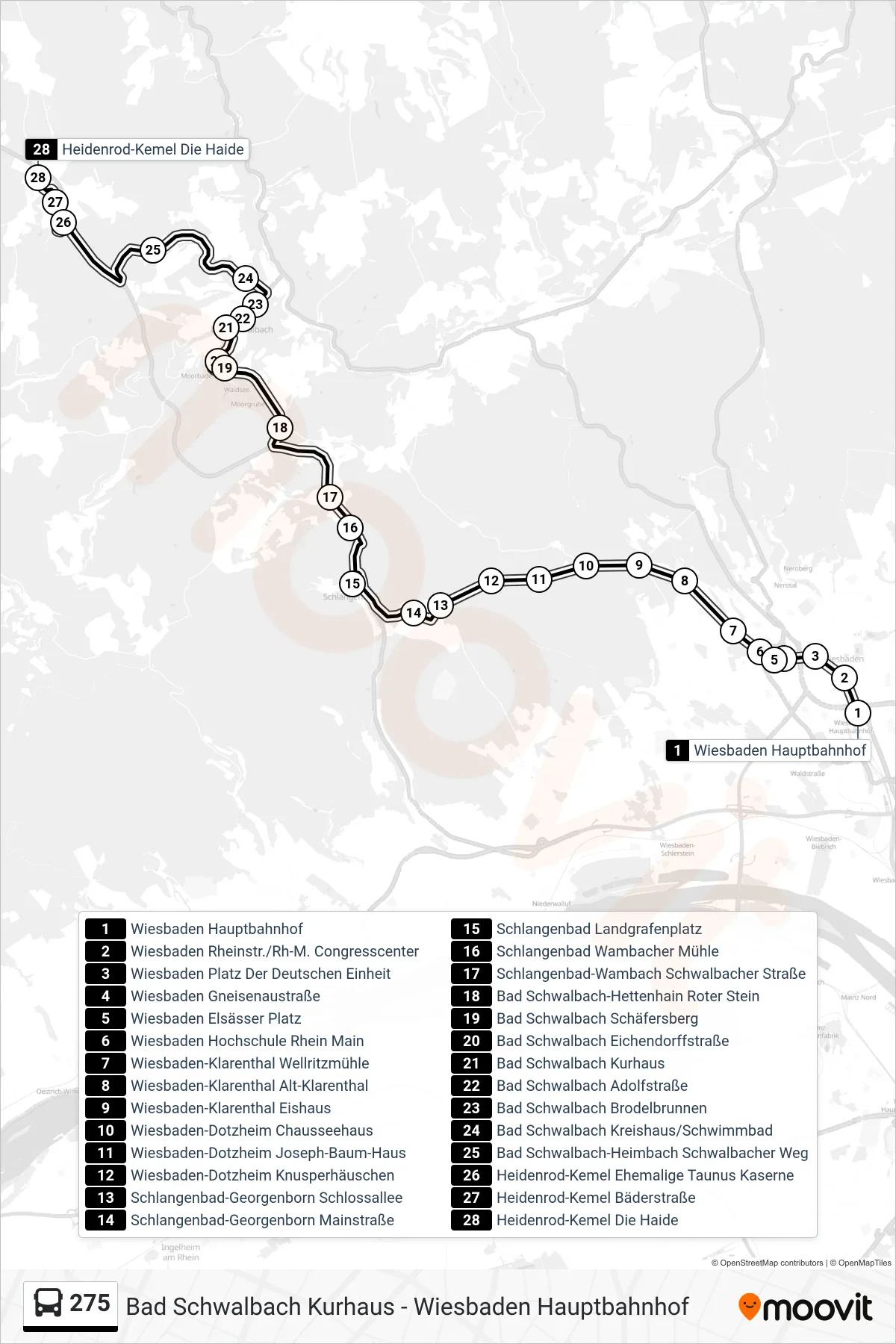
Stops list (275 - Heidenrod-Kemel Die Haide)
- Wiesbaden Hauptbahnhof
- Wiesbaden Rheinstr./Rh-M. Congresscenter
- Wiesbaden Platz Der Deutschen Einheit
- Wiesbaden Gneisenaustraße
- Wiesbaden Elsässer Platz
- Wiesbaden Hochschule Rhein Main
- Wiesbaden-Klarenthal Wellritzmühle
- Wiesbaden-Klarenthal Alt-Klarenthal
- Wiesbaden-Klarenthal Eishaus
- Wiesbaden-Dotzheim Chausseehaus
- Wiesbaden-Dotzheim Joseph-Baum-Haus
- Wiesbaden-Dotzheim Knusperhäuschen
- Schlangenbad-Georgenborn Schlossallee
- Schlangenbad-Georgenborn Mainstraße
- Schlangenbad Landgrafenplatz
- Schlangenbad Wambacher Mühle
- Schlangenbad-Wambach Schwalbacher Straße
- Bad Schwalbach-Hettenhain Roter Stein
- Bad Schwalbach Schäfersberg
- Bad Schwalbach Eichendorffstraße
- Bad Schwalbach Kurhaus
- Bad Schwalbach Adolfstraße
- Bad Schwalbach Brodelbrunnen
- Bad Schwalbach Kreishaus/Schwimmbad
- Bad Schwalbach-Heimbach Schwalbacher Weg
- Heidenrod-Kemel Ehemalige Taunus Kaserne
- Heidenrod-Kemel Bäderstraße
- Heidenrod-Kemel Die Haide
Change direction
- Route Map - 275 - Schlangenbad-Bärstadt Grundschule
- Route Map - 275 - Heidenrod-Laufenselden Raiffeisenstraße
- Route Map - 275 - Katzenelnbogen Rheinstraße
- Route Map - 275 - Schlangenbad Landgrafenplatz
- Route Map - 275 - Bad Schwalbach-Hettenhain Gehrenweg
- Route Map - 275 - Holzhausen A D H Gewerbegebiet Reutig
- Route Map - 275 - Wiesbaden Berufsschulzentrum
- Route Map - 275 - Wiesbaden Hauptbahnhof
- Route Map - 275 - Bad Schwalbach Nao-Schule
- Route Map - 275 - Nastätten Busbahnhof
- Route Map - 275 - Schlangenbad-Hausen V.D.H. Taunusstraße
- Route Map - 275 - Bad Schwalbach Kurhaus