
27E Bus Route Map
View the 27E route map and see all 27E stops along the route. The map of 27E shows where the bus travels and the location of each stop, making it easy to understand the entire route at a glance.
Explore Transport Board routes on the map and see where Transport Board bus services operate. Use the 27E map to find bus stops and see how the 27E connects different areas along its trip.
All 27E stops on the map are displayed in route order, helping you follow the 27E bus from the first stop to the last.
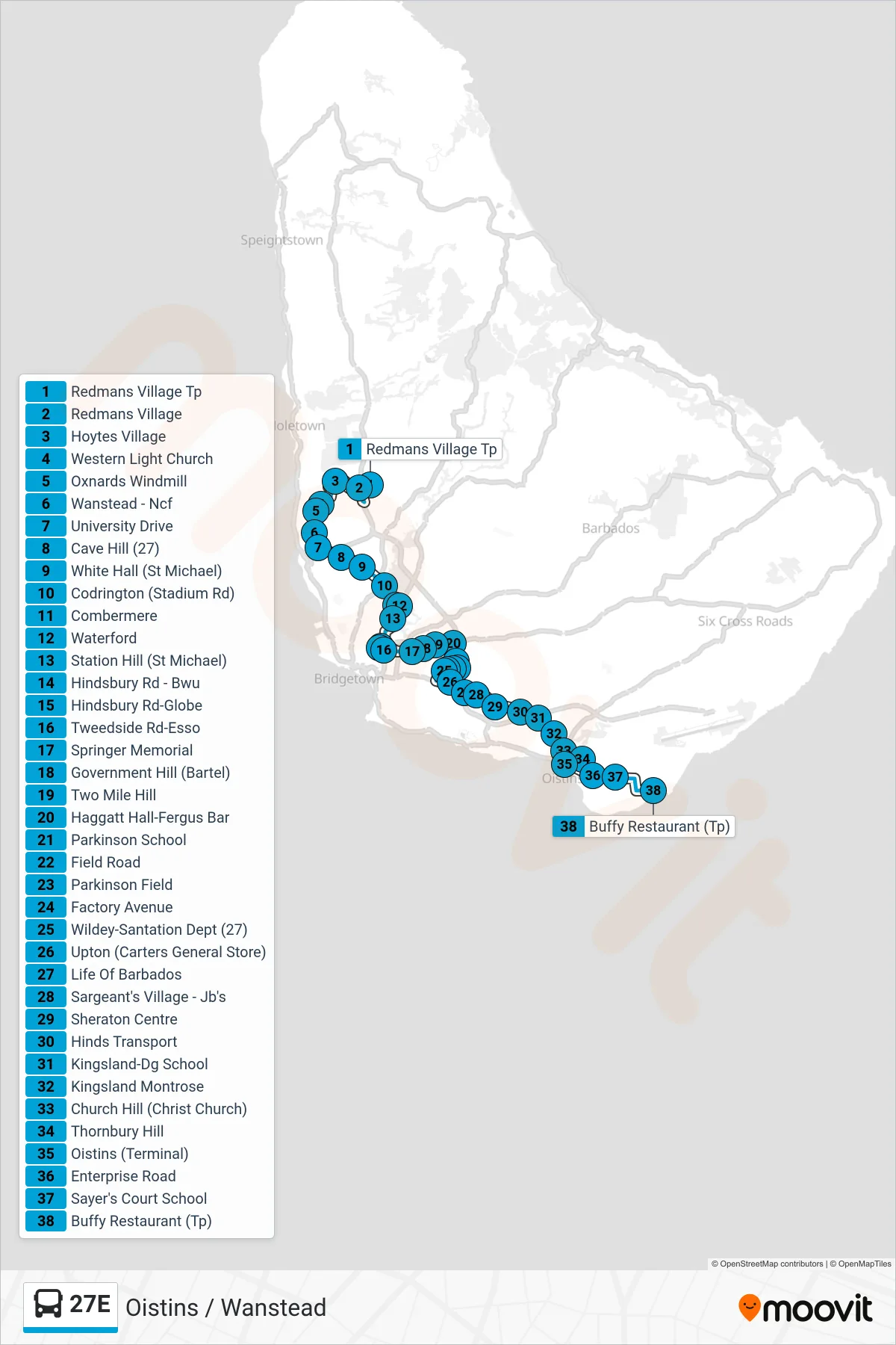
Stops list (27E - Oistins To Wanstead)
- Redmans Village Tp
- Redmans Village
- Hoytes Village
- Western Light Church
- Oxnards Windmill
- Wanstead - Ncf
- University Drive
- Cave Hill (27)
- White Hall (St Michael)
- Codrington (Stadium Rd)
- Combermere
- Waterford
- Station Hill (St Michael)
- Hindsbury Rd - Bwu
- Hindsbury Rd-Globe
- Tweedside Rd-Esso
- Springer Memorial
- Government Hill (Bartel)
- Two Mile Hill
- Haggatt Hall-Fergus Bar
- Parkinson School
- Field Road
- Parkinson Field
- Factory Avenue
- Wildey-Santation Dept (27)
- Upton (Carters General Store)
- Life Of Barbados
- Sargeant's Village - Jb's
- Sheraton Centre
- Hinds Transport
- Kingsland-Dg School
- Kingsland Montrose
- Church Hill (Christ Church)
- Thornbury Hill
- Oistins (Terminal)
- Enterprise Road
- Sayer's Court School
- Buffy Restaurant (Tp)