
28D Light Rail Route Map
View the 28D route map and see all 28D stops along the route. The map of 28D shows where the light rail travels and the location of each stop, making it easy to understand the entire route at a glance.
Explore KP Kyivpastrans routes on the map and see where KP Kyivpastrans light rail services operate. Use the 28D map to find light rail stations and see how the 28D connects different areas along its trip.
All 28D stops on the map are displayed in route order, helping you follow the 28D light rail from the first station to the last.
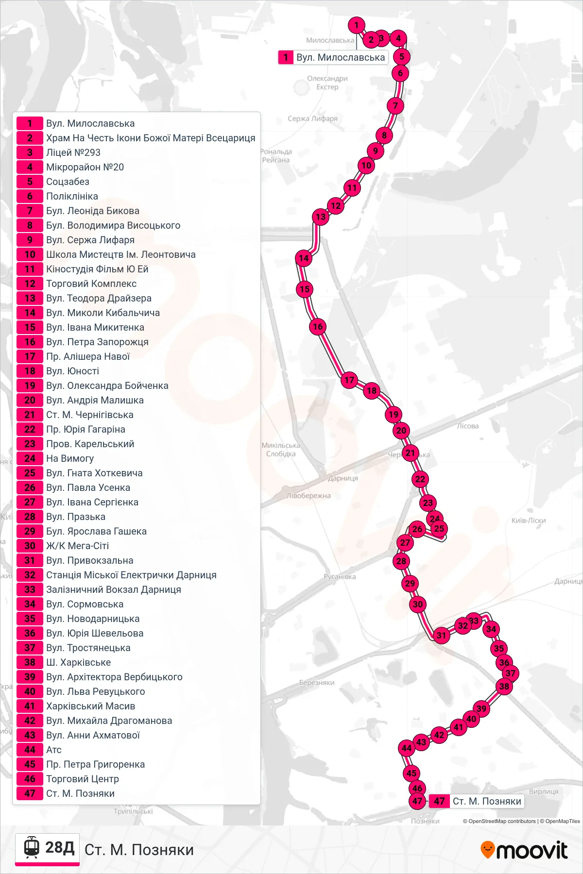
Stops list (28D - Pozniaky Metro Station)
- Myloslavska St.
- Church of the Icon of the Mother of God Vsetsarytsia
- Lyceum #293
- Microdistrict 20
- Social Security Office
- Polyclinic
- Leonid Bykov Blvd
- Volodymyr Vysotsky Boulevard
- Serzha Lyfaria Street
- Leontovych School of Arts
- Film UA Studio
- Shopping Complex
- Theodore Dreiser Street
- Mykola Kybalchych St.
- Ivana Mykytenka St
- Petra Zaporozhtsia St
- Alisher Navoi Avenue
- Youth Street
- Oleksandra Boichenka Street
- Andriy Malyshko Street
- Chernihivska Metro Station
- Yuri Gagarin Avenue
- Karelsky Lane
- On Demand
- Hnat Khotkevych Street
- Pavla Usenka St
- Ivan Serhienko Street
- Prazka Street
- Yaroslava Hasheka Boulevard
- Mega City Complex
- Pryvokzalna Street
- Darnytsia City Train Station
- Darnytsia Railway Station
- Sormovska Street
- Novodarnytska Street
- Yurii Shevelov Street
- Trostianetska Street
- Kharkivske Highway
- Arkhitektora Verbytskoho Street
- Lev Revutskyi Street
- Kharkivskyi District
- Mykhailo Drahomanov St
- Anna Akhmatova Street
- Ats
- Petra Hryhorenka Ave
- Shopping Center
- Pozniaky Metro Station