
28 Bus Route Map
View the 28 route map and see all 28 stops along the route. The map of 28 shows where the bus travels and the location of each stop, making it easy to understand the entire route at a glance.
Explore De Lijn routes on the map and see where De Lijn bus services operate. Use the 28 map to find bus stops and see how the 28 connects different areas along its trip.
All 28 stops on the map are displayed in route order, helping you follow the 28 bus from the first stop to the last.
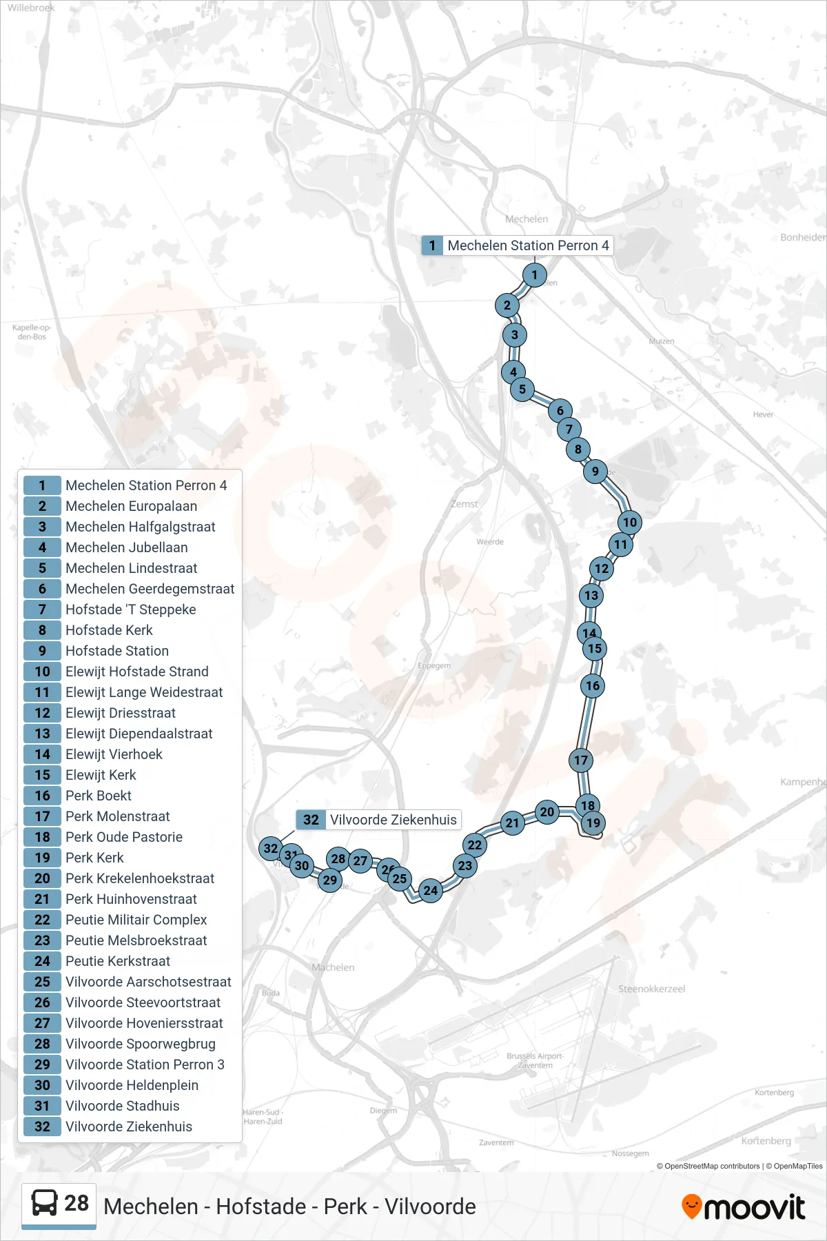
Stops list (28 - Vilvoorde Hospital)
- Mechelen Station Platform 4
- Mechelen Europa Avenue
- Mechelen Halfgalgstraat
- Mechelen Jubilee Avenue
- Mechelen Linde Street
- Mechelen Geerdegemstraat
- Hofstade 'T Steppeke
- Hofstade Church
- Hofstade Station
- Elewijt Hofstade Beach
- Elewijt Long Meadow Street
- Elewijt Dries Street
- Elewijt Diependaal Street
- Elewijt Four Corners
- Elewijt Church
- Perk Boekt
- Perk Mill Street
- Perk Old Rectory
- Perk Church
- Perk Krekelen Corner Street
- Perk Huinhoven Street
- Peutie Military Complex
- Peutie Melsbroek Street
- Peutie Church Street
- Vilvoorde Aarschot Street
- Vilvoorde Steevoort Street
- Vilvoorde Gardeners Street
- Vilvoorde Railway Bridge
- Vilvoorde Station Platform 3
- Vilvoorde Heroes Square
- Vilvoorde City Hall
- Vilvoorde Hospital