
28 Bus Route Map
View the 28 route map and see all 28 stops along the route. The map of 28 shows where the bus travels and the location of each stop, making it easy to understand the entire route at a glance.
Explore County Connection routes on the map and see where County Connection bus services operate. Use the 28 map to find bus stops and see how the 28 connects different areas along its trip.
All 28 stops on the map are displayed in route order, helping you follow the 28 bus from the first stop to the last.
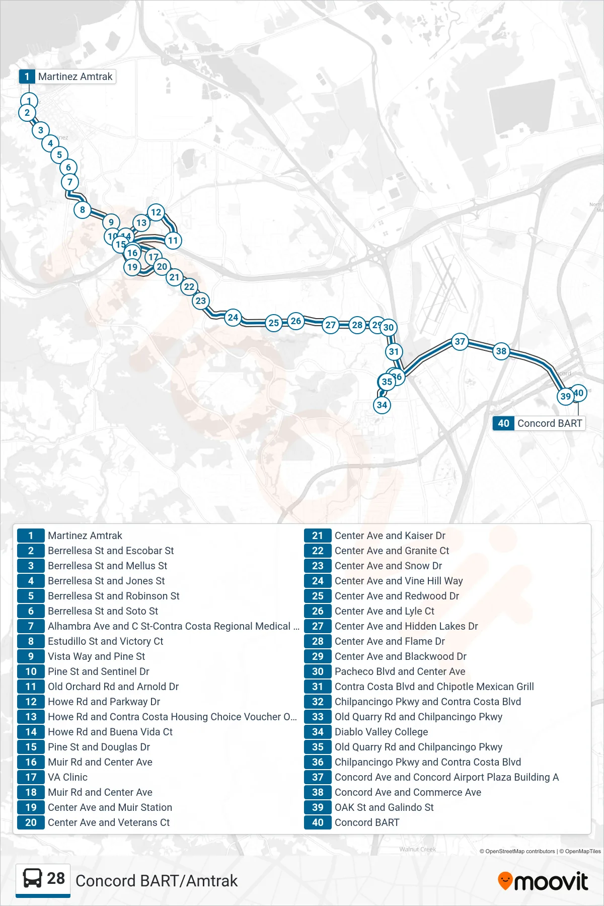
Stops list (28 - Concord BART via VA Clinic and DVC)
- Martinez Amtrak
- Berrellesa St and Escobar St
- Berrellesa St and Mellus St
- Berrellesa St and Jones St
- Berrellesa St and Robinson St
- Berrellesa St and Soto St
- Alhambra Ave and C St-Contra Costa Regional Medical Center
- Estudillo St and Victory Ct
- Vista Way and Pine St
- Pine St and Sentinel Dr
- Old Orchard Rd and Arnold Dr
- Howe Rd and Parkway Dr
- Howe Rd and Contra Costa Housing Choice Voucher Office
- Howe Rd and Buena Vida Ct
- Pine St and Douglas Dr
- Muir Rd and Center Ave
- VA Clinic
- Muir Rd and Center Ave
- Center Ave and Muir Station
- Center Ave and Veterans Ct
- Center Ave and Kaiser Dr
- Center Ave and Granite Ct
- Center Ave and Snow Dr
- Center Ave and Vine Hill Way
- Center Ave and Redwood Dr
- Center Ave and Lyle Ct
- Center Ave and Hidden Lakes Dr
- Center Ave and Flame Dr
- Center Ave and Blackwood Dr
- Pacheco Blvd and Center Ave
- Contra Costa Blvd and Chipotle Mexican Grill
- Chilpancingo Pkwy and Contra Costa Blvd
- Old Quarry Rd and Chilpancingo Pkwy
- Diablo Valley College
- Old Quarry Rd and Chilpancingo Pkwy
- Chilpancingo Pkwy and Contra Costa Blvd
- Concord Ave and Concord Airport Plaza Building A
- Concord Ave and Commerce Ave
- OAK St and Galindo St
- Concord BART