
28 Bus Route Map
View the 28 route map and see all 28 stops along the route. The map of 28 shows where the bus travels and the location of each stop, making it easy to understand the entire route at a glance.
Explore SamTrans routes on the map and see where SamTrans bus services operate. Use the 28 map to find bus stops and see how the 28 connects different areas along its trip.
All 28 stops on the map are displayed in route order, helping you follow the 28 bus from the first stop to the last.
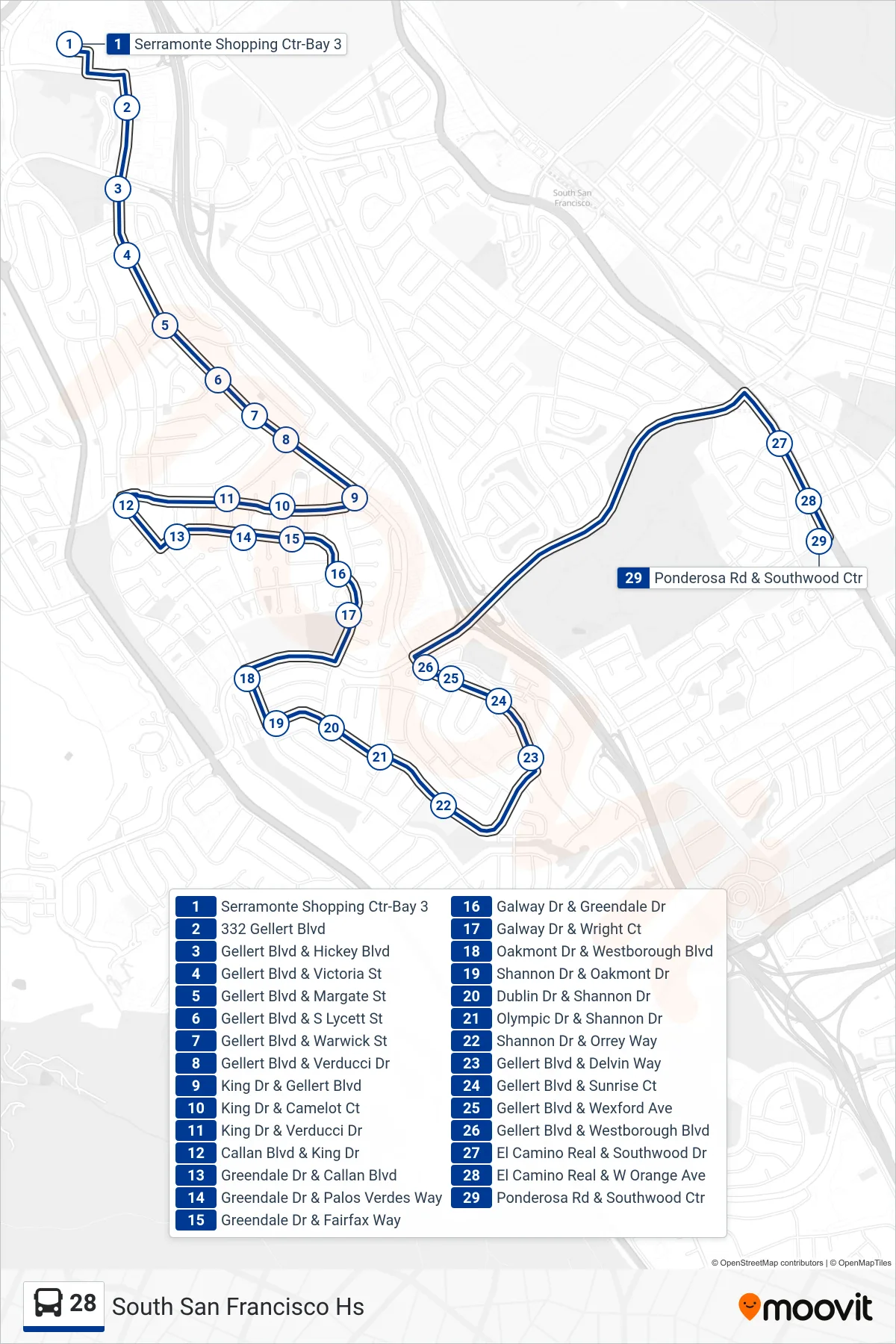
Stops list (28 - South San Francisco Hs)
- Serramonte Shopping Ctr-Bay 3
- 332 Gellert Blvd
- Gellert Blvd & Hickey Blvd
- Gellert Blvd & Victoria St
- Gellert Blvd & Margate St
- Gellert Blvd & S Lycett St
- Gellert Blvd & Warwick St
- Gellert Blvd & Verducci Dr
- King Dr & Gellert Blvd
- King Dr & Camelot Ct
- King Dr & Verducci Dr
- Callan Blvd & King Dr
- Greendale Dr & Callan Blvd
- Greendale Dr & Palos Verdes Way
- Greendale Dr & Fairfax Way
- Galway Dr & Greendale Dr
- Galway Dr & Wright Ct
- Oakmont Dr & Westborough Blvd
- Shannon Dr & Oakmont Dr
- Dublin Dr & Shannon Dr
- Olympic Dr & Shannon Dr
- Shannon Dr & Orrey Way
- Gellert Blvd & Delvin Way
- Gellert Blvd & Sunrise Ct
- Gellert Blvd & Wexford Ave
- Gellert Blvd & Westborough Blvd
- El Camino Real & Southwood Dr
- El Camino Real & W Orange Ave
- Ponderosa Rd & Southwood Ctr