
28 Bus Route Map
View the 28 route map and see all 28 stops along the route. The map of 28 shows where the bus travels and the location of each stop, making it easy to understand the entire route at a glance.
Explore Montgomery County Ride On routes on the map and see where Montgomery County Ride On bus services operate. Use the 28 map to find bus stops and see how the 28 connects different areas along its trip.
All 28 stops on the map are displayed in route order, helping you follow the 28 bus from the first stop to the last.
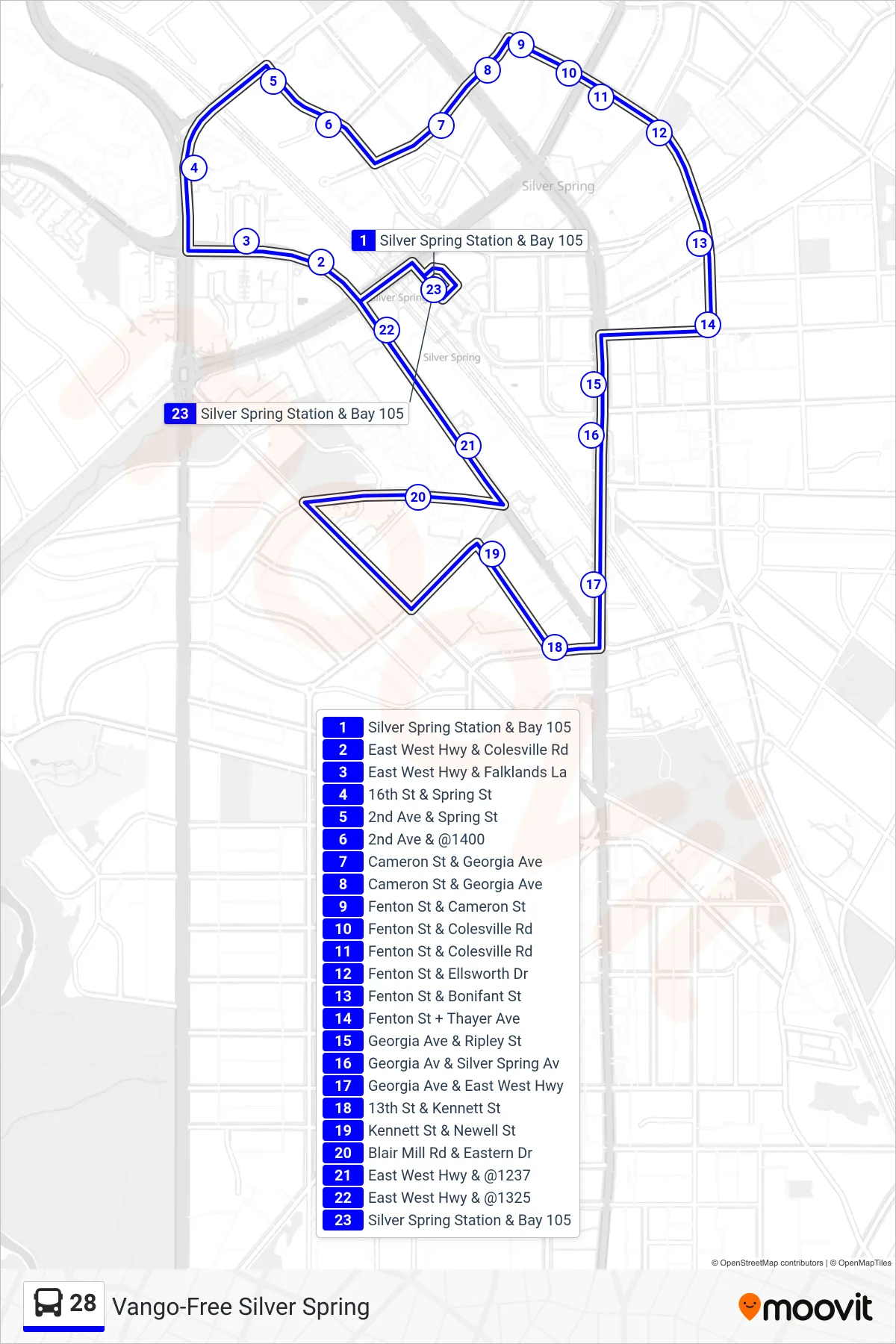
Stops list (28 - Vango-Free Silver Spring)
- Silver Spring Station & Bay 105
- East West Hwy & Colesville Rd
- East West Hwy & Falklands La
- 16th St & Spring St
- 2nd Ave & Spring St
- 2nd Ave & @1400
- Cameron St & Georgia Ave
- Cameron St & Georgia Ave
- Fenton St & Cameron St
- Fenton St & Colesville Rd
- Fenton St & Colesville Rd
- Fenton St & Ellsworth Dr
- Fenton St & Bonifant St
- Fenton St + Thayer Ave
- Georgia Ave & Ripley St
- Georgia Av & Silver Spring Av
- Georgia Ave & East West Hwy
- 13th St & Kennett St
- Kennett St & Newell St
- Blair Mill Rd & Eastern Dr
- East West Hwy & @1237
- East West Hwy & @1325
- Silver Spring Station & Bay 105