
280 Bus Route Map
View the 280 route map and see all 280 stops along the route. The map of 280 shows where the bus travels and the location of each stop, making it easy to understand the entire route at a glance.
Explore Birmingham routes on the map and see where Birmingham bus services operate. Use the 280 map to find bus stops and see how the 280 connects different areas along its trip.
All 280 stops on the map are displayed in route order, helping you follow the 280 bus from the first stop to the last.
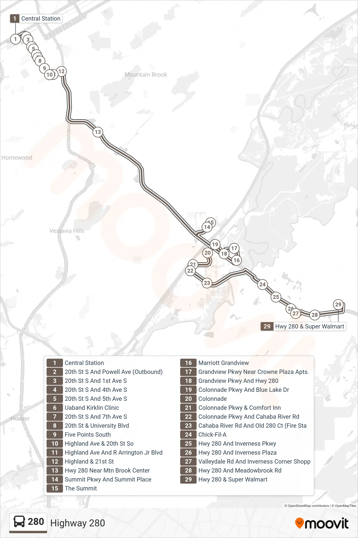
Stops list (280 - Central Station→Hwy 280 & Super Walmart)
- Central Station
- 20th St S And Powell Ave (Outbound)
- 20th St S And 1st Ave S
- 20th St S And 4th Ave S
- 20th St S And 5th Ave S
- Uaband Kirklin Clinic
- 20th St S And 7th Ave S
- 20th St & University Blvd
- Five Points South
- Highland Ave & 20th St So
- Highland Ave And R Arrington Jr Blvd
- Highland & 21st St
- Hwy 280 Near Mtn Brook Center
- Summit Pkwy And Summit Place
- The Summit
- Marriott Grandview
- Grandview Pkwy Near Crowne Plaza Apts.
- Grandview Pkwy And Hwy 280
- Colonnade Pkwy And Blue Lake Dr
- Colonnade
- Colonnade Pkwy & Comfort Inn
- Colonnade Pkwy And Cahaba River Rd
- Cahaba River Rd And Old 280 Ct (Fire Sta
- Chick-Fil-A
- Hwy 280 And Inverness Pkwy
- Hwy 280 And Inverness Plaza
- Valleydale Rd And Inverness Corner Shopp
- Hwy 280 And Meadowbrook Rd
- Hwy 280 & Super Walmart