
280 Bus Route Map
View the 280 route map and see all 280 stops along the route. The map of 280 shows where the bus travels and the location of each stop, making it easy to understand the entire route at a glance.
Explore Nazareth Travel and Tourism routes on the map and see where Nazareth Travel and Tourism bus services operate. Use the 280 map to find bus stops and see how the 280 connects different areas along its trip.
All 280 stops on the map are displayed in route order, helping you follow the 280 bus from the first stop to the last.
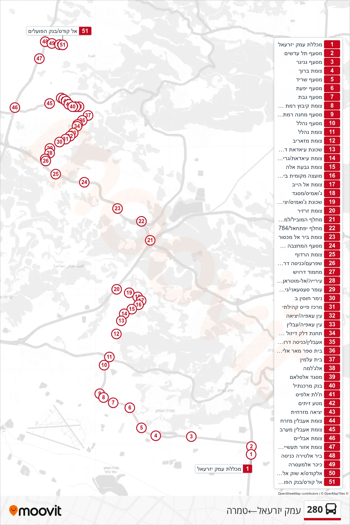
Stops list (280 - Emek Yizre'el→Tamra)
- Emek Yizrael College
- Tel Adashim Junction
- Genigar Junction
- Baruch Junction
- Sarid Junction
- Yifat Junction
- Gvat Junction
- Kibbutz Ramat David Junction
- Ramat David Base Junction
- Nahalal Junction
- Nahalal Junction
- Mazarib Junction
- Southern Ayadat Neighborhood
- Ayadat/Grifat Junction
- Givat Ela Junction
- Beit Zarzir Local Council
- Al Hib Junction
- Jawamis/Mosque
- Jawamis Neighborhood/Exit
- Zarzir Junction
- Hamoovil Interchange/West
- Yiftachel Junction/784
- Bir al-Maksur Junction
- Quarry West Junction/Road 79
- Harduf Junction
- Shfaram/South Entrance
- Mahmoud Darwish
- Municipality/Al-Mutran Hajar
- Omar Sasaani/Nimer Hussein
- Nimer Hussein B
- Pais Community Center
- Ein Afia/Exit
- Ein Afia/Iblin
- Ibillin Diesel Gas Station
- Iblin/South Entrance
- Mar Elias School
- Cemetery
- Al-Jalama
- Al-Salam Mosque
- Bank Mercantile
- Khalet al-Fis
- Olive Grove
- Eastern Exit
- Iblin East Junction
- Iblin West Junction
- Avlayim Junction
- Tamra Industrial Zone Junction
- Bir Al-Tira Entrance
- Al-Masara Square
- Al-Quds/Old Market
- Al Quds/Bank Hapoalim