
28EXTR Bus Route Map
View the 28EXTR route map and see all 28EXTR stops along the route. The map of 28EXTR shows where the bus travels and the location of each stop, making it easy to understand the entire route at a glance.
Explore Start routes on the map and see where Start bus services operate. Use the 28EXTR map to find bus stops and see how the 28EXTR connects different areas along its trip.
All 28EXTR stops on the map are displayed in route order, helping you follow the 28EXTR bus from the first stop to the last.
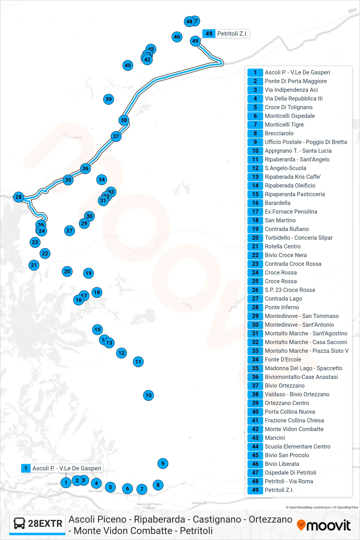
Stops list (28EXTR - Petritoli Industrial Zone)
- Ascoli Piceno - De Gasperi Avenue
- Porta Maggiore Bridge
- Independence Street ACI
- Via Della Repubblica ITI
- Tolignano Cross
- Monticelli Hospital
- Monticelli Tigre
- Brecciarolo
- Post Office - Poggio Di Bretta
- Appignano T. - Santa Lucia
- Ripaberarda - Sant'Angelo
- Sant'Angelo School
- Ripaberada Kris Cafe
- Ripaberada Oil Mill
- Ripaperarda Pastry Shop
- Barardella
- Ex Fornace Bus Shelter
- San Martino
- Rufiano District
- Torbidello - Silpar Tannery
- Rotella Centro
- Black Cross Junction
- Red Cross District
- Red Cross
- Red Cross
- SP 23 Red Cross
- Lake District
- Hell's Bridge
- Montedinove - San Tommaso
- Montedinove - Saint Anthony
- Montalto Marche - Saint Augustine
- Montalto Marche - Sacconi House
- Montalto Marche - Piazza Sisto V
- Fonte D'Ercole
- Madonna Del Lago - Spaccetto
- Montalto Junction-Case Anastasi
- Ortezzano Junction
- Valdaso - Ortezzano Junction
- Ortezzano Center
- New Hill Gate
- Collina Church District
- Monte Vidon Combatte
- Mancini
- Central Elementary School
- San Procolo Junction
- Liberata Junction
- Petritoli Hospital
- Petritoli - Roma Street
- Petritoli Industrial Zone
Change direction
- Route Map - 28EXTR - Castignano - Terminal
- Route Map - 28EXTR - Rotella Centro
- Route Map - 28EXTR - Patrignone
- Route Map - 28EXTR - San Martino District
- Route Map - 28EXTR - Ripaberarda - Sant'Angelo
- Route Map - 28EXTR - Ascoli Piceno - De Gasperi Avenue
- Route Map - 28EXTR - Castiglioni
- Route Map - 28EXTR - Ripaberarda - Sant'Angelo
- Route Map - 28EXTR - Montalto Marche - Piazza Sisto V
- Route Map - 28EXTR - Castignano - Terminal
- Route Map - 28EXTR - Ponte Tesino
- Route Map - 28EXTR - Rotella Centro
- Route Map - 28EXTR - Red Cross
- Route Map - 28EXTR - Castel Di Lama - Bar Sport