
29 Bus Route Map
View the 29 route map and see all 29 stops along the route. The map of 29 shows where the bus travels and the location of each stop, making it easy to understand the entire route at a glance.
Explore Kavim routes on the map and see where Kavim bus services operate. Use the 29 map to find bus stops and see how the 29 connects different areas along its trip.
All 29 stops on the map are displayed in route order, helping you follow the 29 bus from the first stop to the last.
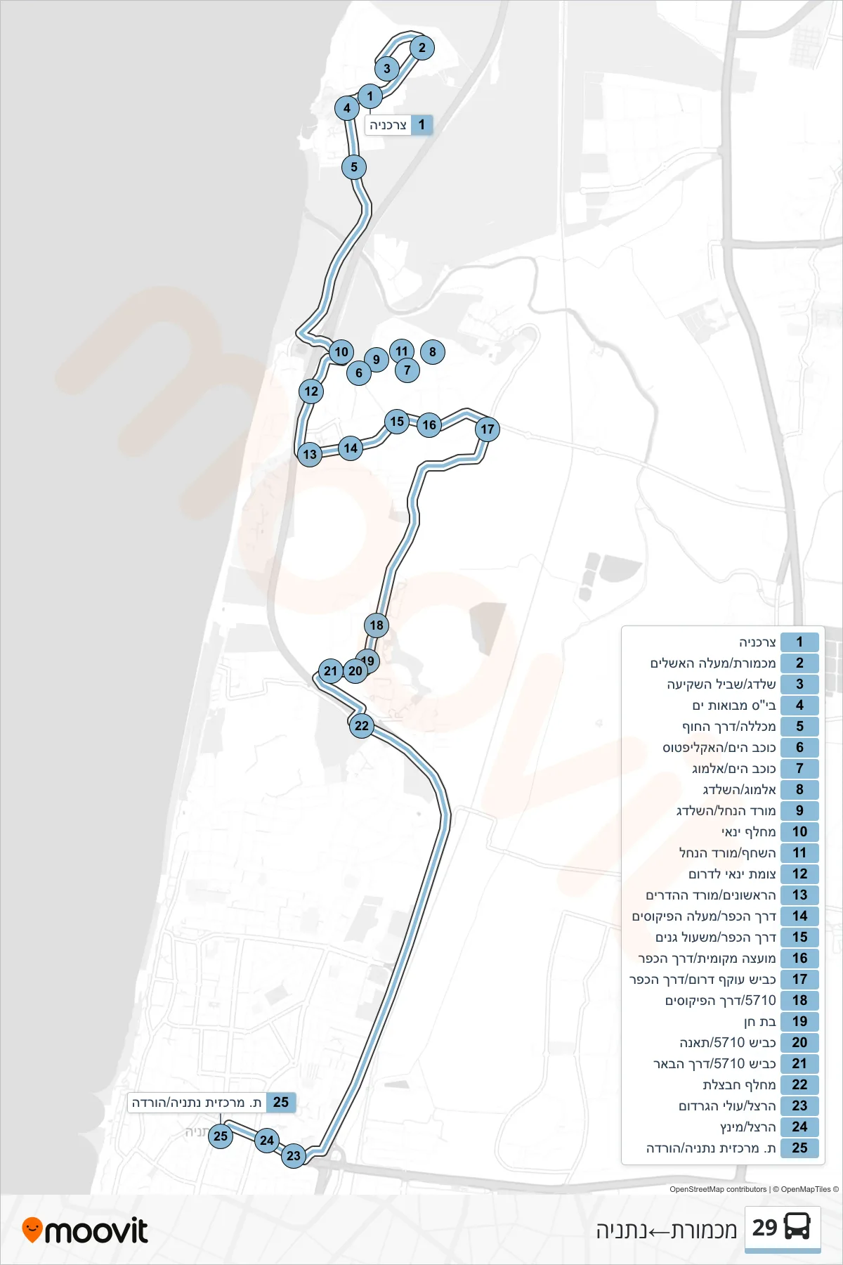
Stops list (29 - Mikhmoret→Netanya)
- Grocery Store
- Michmoret/Ma'ale HaAshlaim
- Shaldag/Sunset Path
- Mevoot Yam School
- College/Coastal Road
- Kochav HaYam/HaEucalyptus
- Kochav HaYam/Almog
- Almog/HaShaldag
- Morad HaNahal/HaShaldag
- Yanai Interchange
- HaShachaf/Morad HaNachal
- Yanai Junction South
- HaRishonim/Morad HaHadarim
- Derech HaKfar/Ma'ale HaPikusim
- Derech HaKfar/Mishol Ganim
- Local Council/Village Road
- Southern Bypass Road/Village Road
- 5710/Ficus Road
- Bat Hen
- Road 5710/Te'ena
- Road 5710/Well Road
- Havatzelet Interchange
- Herzl/Olei HaGardom
- Herzl/Mintz
- Netanya Central Station/Drop Off