
29 Bus Route Map
View the 29 route map and see all 29 stops along the route. The map of 29 shows where the bus travels and the location of each stop, making it easy to understand the entire route at a glance.
Explore ASTRAL routes on the map and see where ASTRAL bus services operate. Use the 29 map to find bus stops and see how the 29 connects different areas along its trip.
All 29 stops on the map are displayed in route order, helping you follow the 29 bus from the first stop to the last.
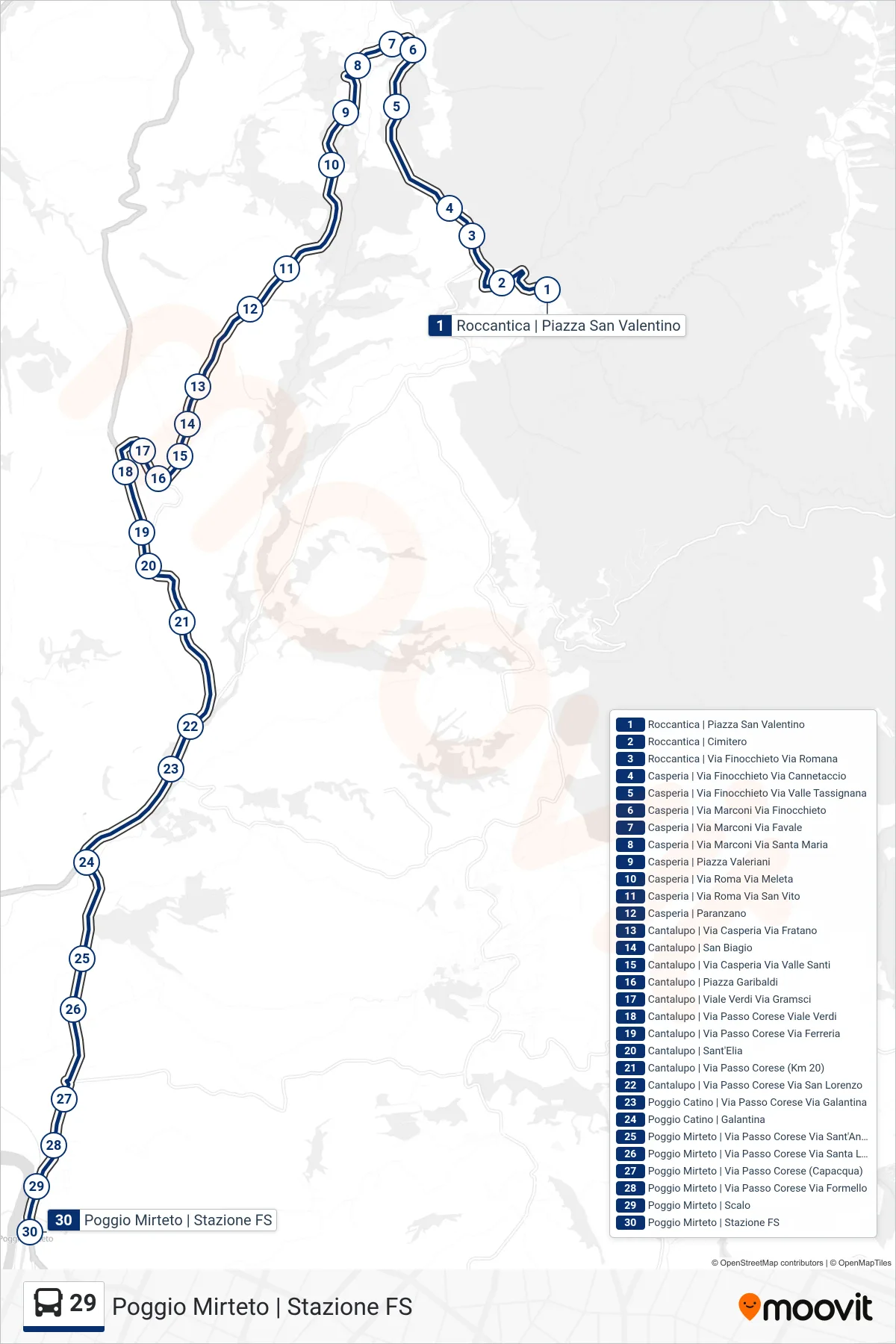
Stops list (29 - Poggio Mirteto | Railway Station)
- Roccantica Piazza San Valentino
- Roccantica | Cemetery
- Roccantica | Via Finocchieto Via Romana
- Casperia | Finocchieto Road Cannetaccio Road
- Casperia | Via Finocchieto Via Valle Tassignana
- Casperia via Marconi via Finocchieto
- Casperia Via Marconi Via Favale
- Marconi Street / Santa Maria Street - Casperia
- Casperia Valeriani Square
- Casperia | Rome Street Meleta Street
- Casperia | Rome Road San Vito Road
- Casperia | Paranzano
- Cantalupo | Casperia St Fratano St
- Cantalupo | San Biagio
- Cantalupo | Casperia Road Valle Santi Road
- Cantalupo via Piazza Garibaldi
- Cantalupo | Verdi Avenue Gramsci Street
- Cantalupo | Passo Corese Road Verdi Avenue
- Cantalupo | Passo Corese Street Ferreria Street
- Cantalupo | Sant'Elia
- Cantalupo | Passo Corese Road (Km 20)
- Cantalupo | Passo Corese Street San Lorenzo Street
- Poggio Catino | Passo Corese Street Galantina Street
- Poggio Catino | Galantina
- Poggio Mirteto | Passo Corese Street Sant'Angelo Street
- Poggio Mirteto | Passo Corese Street Santa Lucia Street
- Poggio Mirteto | Passo Corese Street (Capacqua)
- Poggio Mirteto | Passo Corese Street Formello Street
- Poggio Mirteto | Station
- Poggio Mirteto | Railway Station