
29 Bus Route Map
View the 29 route map and see all 29 stops along the route. The map of 29 shows where the bus travels and the location of each stop, making it easy to understand the entire route at a glance.
Explore RÖHLER Touristik GmbH routes on the map and see where RÖHLER Touristik GmbH bus services operate. Use the 29 map to find bus stops and see how the 29 connects different areas along its trip.
All 29 stops on the map are displayed in route order, helping you follow the 29 bus from the first stop to the last.
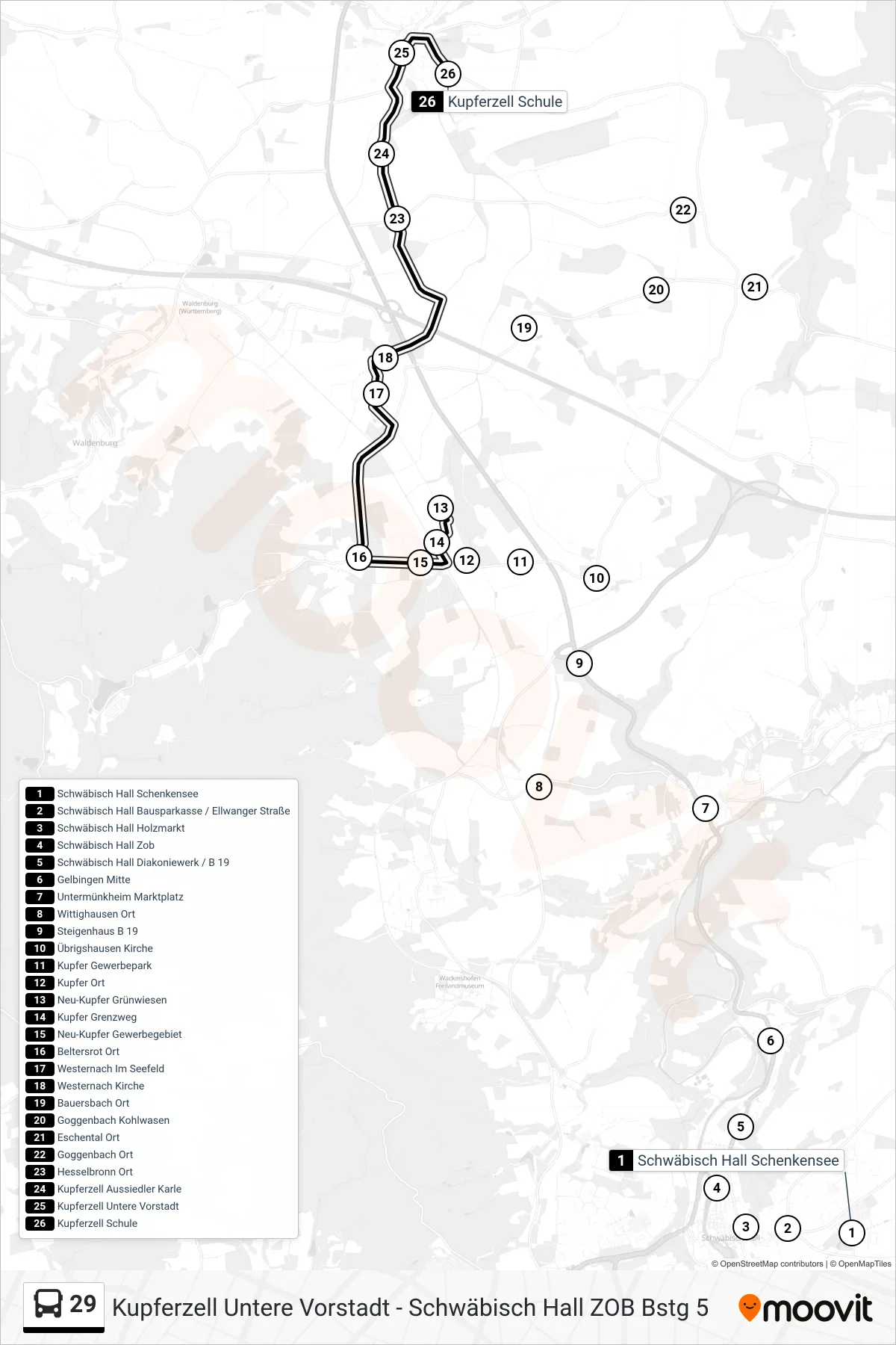
Stops list (29 - Kupferzell Schule)
- Schwäbisch Hall Schenkensee
- Schwäbisch Hall Bausparkasse / Ellwanger Straße
- Schwäbisch Hall Holzmarkt
- Schwäbisch Hall Zob
- Schwäbisch Hall Diakoniewerk / B 19
- Gelbingen Mitte
- Untermünkheim Marktplatz
- Wittighausen Ort
- Steigenhaus B 19
- Übrigshausen Kirche
- Kupfer Gewerbepark
- Kupfer Ort
- Neu-Kupfer Grünwiesen
- Kupfer Grenzweg
- Neu-Kupfer Gewerbegebiet
- Beltersrot Ort
- Westernach Im Seefeld
- Westernach Kirche
- Bauersbach Ort
- Goggenbach Kohlwasen
- Eschental Ort
- Goggenbach Ort
- Hesselbronn Ort
- Kupferzell Aussiedler Karle
- Kupferzell Untere Vorstadt
- Kupferzell Schule