
290 Bus Route Map
View the 290 route map and see all 290 stops along the route. The map of 290 shows where the bus travels and the location of each stop, making it easy to understand the entire route at a glance.
Explore Westerwaldbus routes on the map and see where Westerwaldbus bus services operate. Use the 290 map to find bus stops and see how the 290 connects different areas along its trip.
All 290 stops on the map are displayed in route order, helping you follow the 290 bus from the first stop to the last.
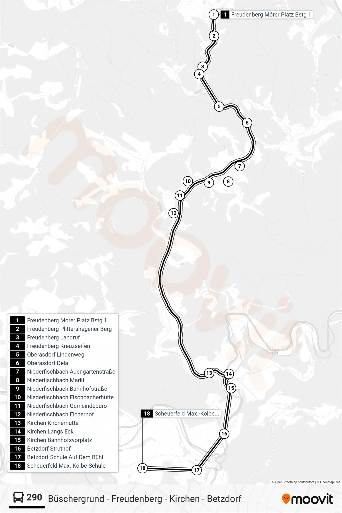
Stops list (290 - Scheuerfeld Max.-Kolbe-Schule)
- Freudenberg Mórer Platz Bstg 1
- Freudenberg Plittershagener Berg
- Freudenberg Landruf
- Freudenberg Kreuzseifen
- Oberasdorf Lindenweg
- Oberasdorf Dela
- Niederfischbach Auengartenstraße
- Niederfischbach Markt
- Niederfischbach Bahnhofstraße
- Niederfischbach Fischbacherhütte
- Niederfischbach Gemeindebüro
- Niederfischbach Eicherhof
- Kirchen Kircherhütte
- Kirchen Langs Eck
- Kirchen Bahnhofsvorplatz
- Betzdorf Struthof
- Betzdorf Schule Auf Dem Bühl
- Scheuerfeld Max.-Kolbe-Schule
Change direction
- Route Map - 290 - Büschergrund Buchenstraße
- Route Map - 290 - Betzdorf Busbahnhof Bstg 7
- Route Map - 290 - Büschergrund Schulzentrum
- Route Map - 290 - Betzdorf Bbs Betzdorf-Kirchen
- Route Map - 290 - Niederfischbach Auengartenstraße
- Route Map - 290 - Freudenberg Ekz Silberstern
- Route Map - 290 - Betzdorf Struthof Bstg D
- Route Map - 290 - Kirchen Bahnhofsvorplatz