
292 Bus Route Map
View the 292 route map and see all 292 stops along the route. The map of 292 shows where the bus travels and the location of each stop, making it easy to understand the entire route at a glance.
Explore SamTrans routes on the map and see where SamTrans bus services operate. Use the 292 map to find bus stops and see how the 292 connects different areas along its trip.
All 292 stops on the map are displayed in route order, helping you follow the 292 bus from the first stop to the last.
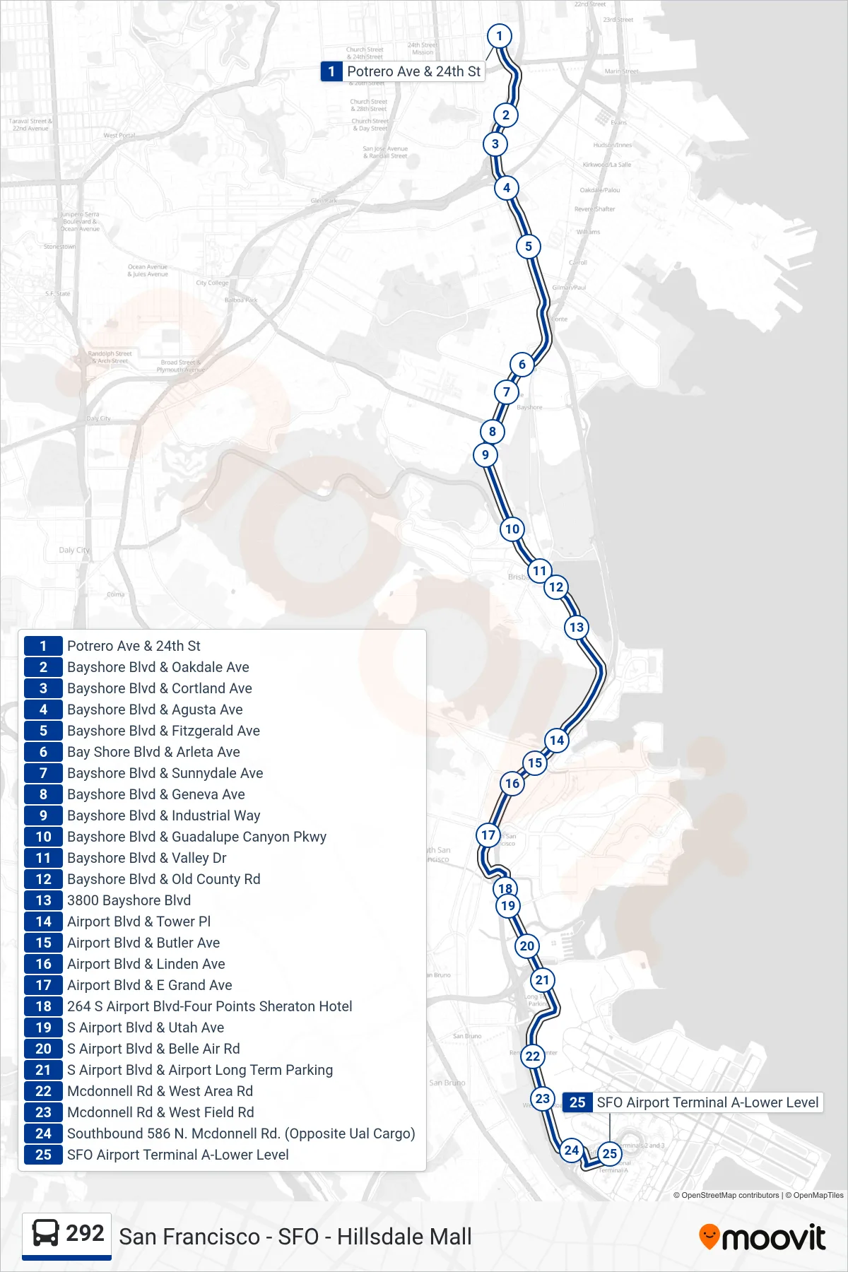
Stops list (292 - SFO)
- Potrero Ave & 24th St
- Bayshore Blvd & Oakdale Ave
- Bayshore Blvd & Cortland Ave
- Bayshore Blvd & Agusta Ave
- Bayshore Blvd & Fitzgerald Ave
- Bay Shore Blvd & Arleta Ave
- Bayshore Blvd & Sunnydale Ave
- Bayshore Blvd & Geneva Ave
- Bayshore Blvd & Industrial Way
- Bayshore Blvd & Guadalupe Canyon Pkwy
- Bayshore Blvd & Valley Dr
- Bayshore Blvd & Old County Rd
- 3800 Bayshore Blvd
- Airport Blvd & Tower Pl
- Airport Blvd & Butler Ave
- Airport Blvd & Linden Ave
- Airport Blvd & E Grand Ave
- 264 S Airport Blvd-Four Points Sheraton Hotel
- S Airport Blvd & Utah Ave
- S Airport Blvd & Belle Air Rd
- S Airport Blvd & Airport Long Term Parking
- Mcdonnell Rd & West Area Rd
- Mcdonnell Rd & West Field Rd
- Southbound 586 N. Mcdonnell Rd. (Opposite Ual Cargo)
- SFO Airport Terminal A-Lower Level