
2A Bus Route Map
View the 2A route map and see all 2A stops along the route. The map of 2A shows where the bus travels and the location of each stop, making it easy to understand the entire route at a glance.
Explore Movia routes on the map and see where Movia bus services operate. Use the 2A map to find bus stops and see how the 2A connects different areas along its trip.
All 2A stops on the map are displayed in route order, helping you follow the 2A bus from the first stop to the last.
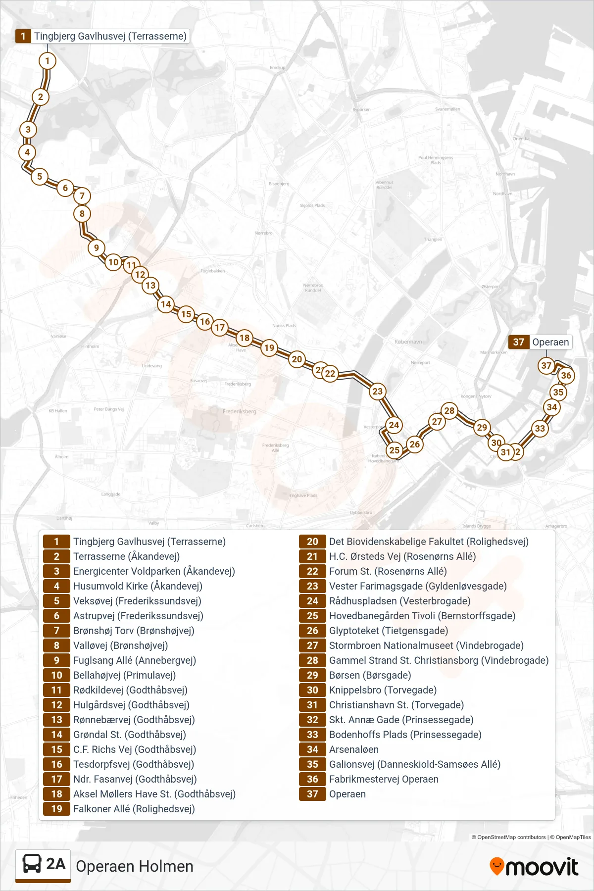
Stops list (2A - Operaen Holmen)
- Tingbjerg Gavlhusvej (Terrasserne)
- Terrasserne (Åkandevej)
- Energicenter Voldparken (Åkandevej)
- Husumvold Kirke (Åkandevej)
- Veksøvej (Frederikssundsvej)
- Astrupvej (Frederikssundsvej)
- Brønshøj Torv (Brønshøjvej)
- Valløvej (Brønshøjvej)
- Fuglsang Allé (Annebergvej)
- Bellahøjvej (Primulavej)
- Rødkildevej (Godthåbsvej)
- Hulgårdsvej (Godthåbsvej)
- Rønnebærvej (Godthåbsvej)
- Grøndal St. (Godthåbsvej)
- C.F. Richs Vej (Godthåbsvej)
- Tesdorpfsvej (Godthåbsvej)
- Ndr. Fasanvej (Godthåbsvej)
- Aksel Møllers Have St. (Godthåbsvej)
- Falkoner Allé (Rolighedsvej)
- Det Biovidenskabelige Fakultet (Rolighedsvej)
- H.C. Ørsteds Vej (Rosenørns Allé)
- Forum St. (Rosenørns Allé)
- Vester Farimagsgade (Gyldenløvesgade)
- Rådhuspladsen (Vesterbrogade)
- Hovedbanegården Tivoli (Bernstorffsgade)
- Glyptoteket (Tietgensgade)
- Stormbroen Nationalmuseet (Vindebrogade)
- Gammel Strand St. Christiansborg (Vindebrogade)
- Børsen (Børsgade)
- Knippelsbro (Torvegade)
- Christianshavn St. (Torvegade)
- Skt. Annæ Gade (Prinsessegade)
- Bodenhoffs Plads (Prinsessegade)
- Arsenaløen
- Galionsvej (Danneskiold-Samsøes Allé)
- Fabrikmestervej Operaen
- Operaen