
2A Bus Route Map
View the 2A route map and see all 2A stops along the route. The map of 2A shows where the bus travels and the location of each stop, making it easy to understand the entire route at a glance.
Explore Wr. Neustädter Stadtwerke u. Kommunal Service GmbH routes on the map and see where Wr. Neustädter Stadtwerke u. Kommunal Service GmbH bus services operate. Use the 2A map to find bus stops and see how the 2A connects different areas along its trip.
All 2A stops on the map are displayed in route order, helping you follow the 2A bus from the first stop to the last.
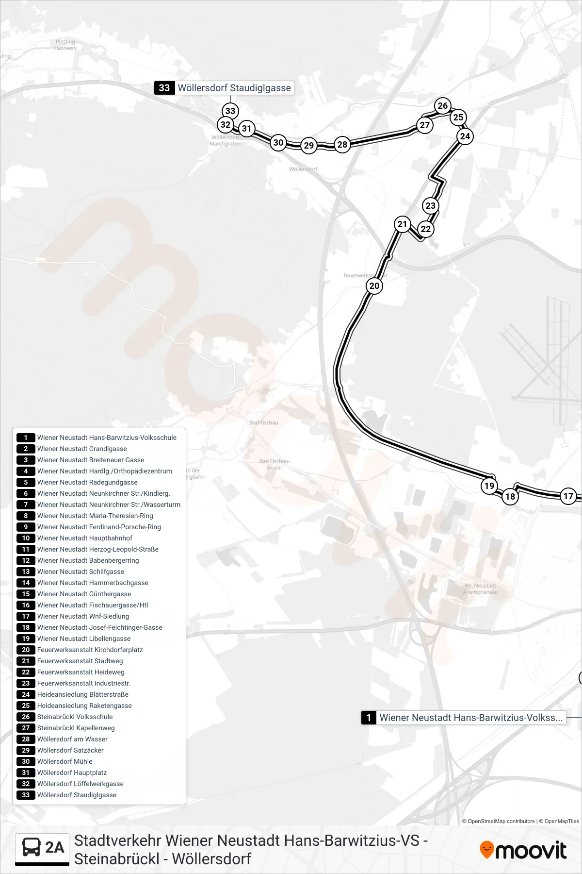

Stops list (2A - Wöllersdorf Staudiglgasse)
- Wiener Neustadt Hans-Barwitzius-Volksschule
- Wiener Neustadt Grandlgasse
- Wiener Neustadt Breitenauer Gasse
- Wiener Neustadt Hardlg./Orthopädiezentrum
- Wiener Neustadt Radegundgasse
- Wiener Neustadt Neunkirchner Str./Kindlerg.
- Wiener Neustadt Neunkirchner Str./Wasserturm
- Wiener Neustadt Maria-Theresien-Ring
- Wiener Neustadt Ferdinand-Porsche-Ring
- Wiener Neustadt Hauptbahnhof
- Wiener Neustadt Herzog-Leopold-Straße
- Wiener Neustadt Babenbergerring
- Wiener Neustadt Schilfgasse
- Wiener Neustadt Hammerbachgasse
- Wiener Neustadt Günthergasse
- Wiener Neustadt Fischauergasse/Htl
- Wiener Neustadt Wnf-Siedlung
- Wiener Neustadt Josef-Feichtinger-Gasse
- Wiener Neustadt Libellengasse
- Feuerwerksanstalt Kirchdorferplatz
- Feuerwerksanstalt Stadtweg
- Feuerwerksanstalt Heideweg
- Feuerwerksanstalt Industriestr.
- Heideansiedlung Blätterstraße
- Heideansiedlung Raketengasse
- Steinabrückl Volksschule
- Steinabrückl Kapellenweg
- Wöllersdorf am Wasser
- Wöllersdorf Satzäcker
- Wöllersdorf Mühle
- Wöllersdorf Hauptplatz
- Wöllersdorf Löffelwerkgasse
- Wöllersdorf Staudiglgasse