
2B Bus Route Map
View the 2B route map and see all 2B stops along the route. The map of 2B shows where the bus travels and the location of each stop, making it easy to understand the entire route at a glance.
Explore Start routes on the map and see where Start bus services operate. Use the 2B map to find bus stops and see how the 2B connects different areas along its trip.
All 2B stops on the map are displayed in route order, helping you follow the 2B bus from the first stop to the last.
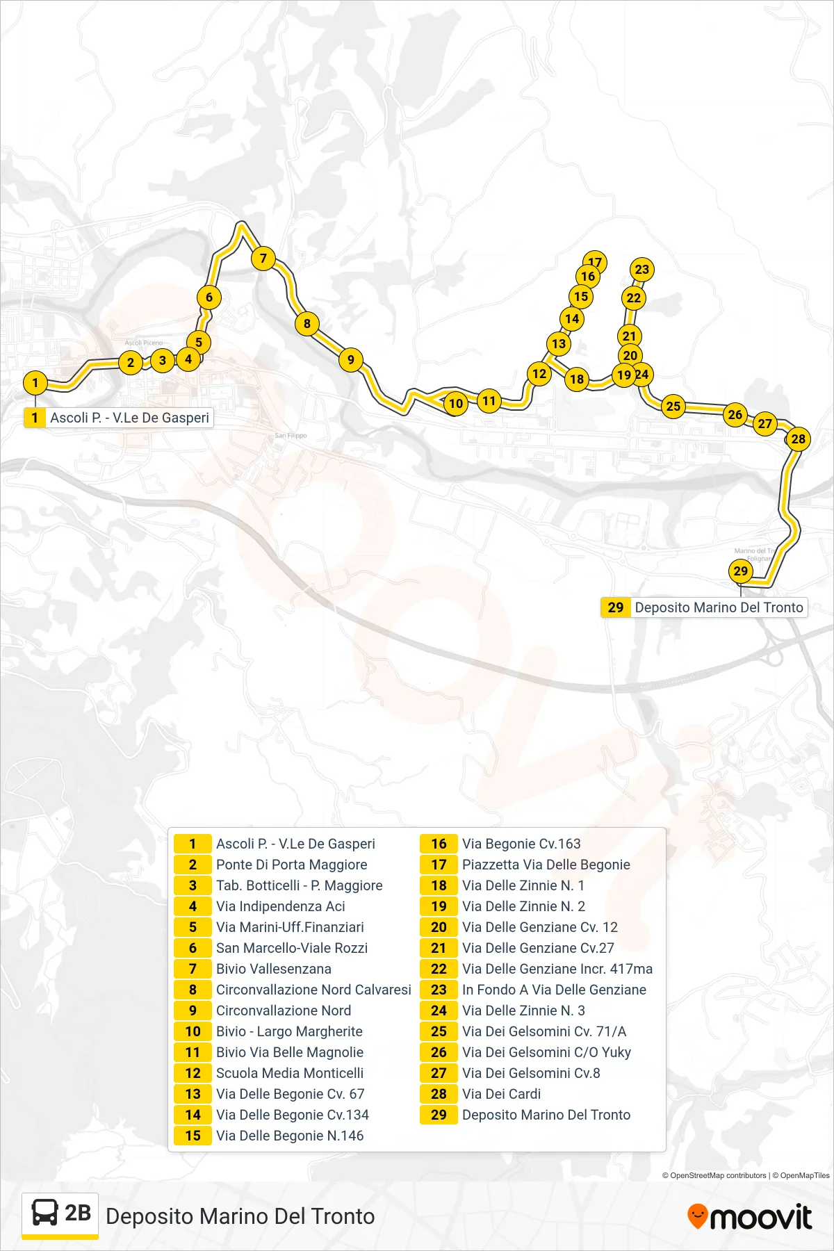
Stops list (2B - Marino Del Tronto Depot)
- Ascoli Piceno - De Gasperi Avenue
- Porta Maggiore Bridge
- Botticelli Stop - P. Maggiore
- Independence Street ACI
- Marini Street-Financial Offices
- San Marcello-Viale Rozzi
- Vallesenzana Junction
- North Ring Road Calvaresi
- North Ring Road
- Junction - Margherite Square
- Belle Magnolie Junction
- Monticelli Middle School
- Via Delle Begonie No. 67
- Via Delle Begonie 134
- Via Delle Begonie 146
- Via Begonie Cv.163
- Little Square Via Delle Begonie
- Zinnie Street No. 1
- Zinnie Street No. 2
- Genziane Street No. 12
- Via Delle Genziane 27
- Via Delle Genziane Junction 417
- End of Genziane Street
- Zinnie Street No. 3
- Via Dei Gelsomini 71/A
- Via Dei Gelsomini Near Yuky
- Gelsomini Street No.8
- Dei Cardi Street
- Marino Del Tronto Depot