
3 Light Rail Route Map
View the 3 route map and see all 3 stops along the route. The map of 3 shows where the light rail travels and the location of each stop, making it easy to understand the entire route at a glance.
Explore BKK routes on the map and see where BKK light rail services operate. Use the 3 map to find light rail stations and see how the 3 connects different areas along its trip.
All 3 stops on the map are displayed in route order, helping you follow the 3 light rail from the first station to the last.
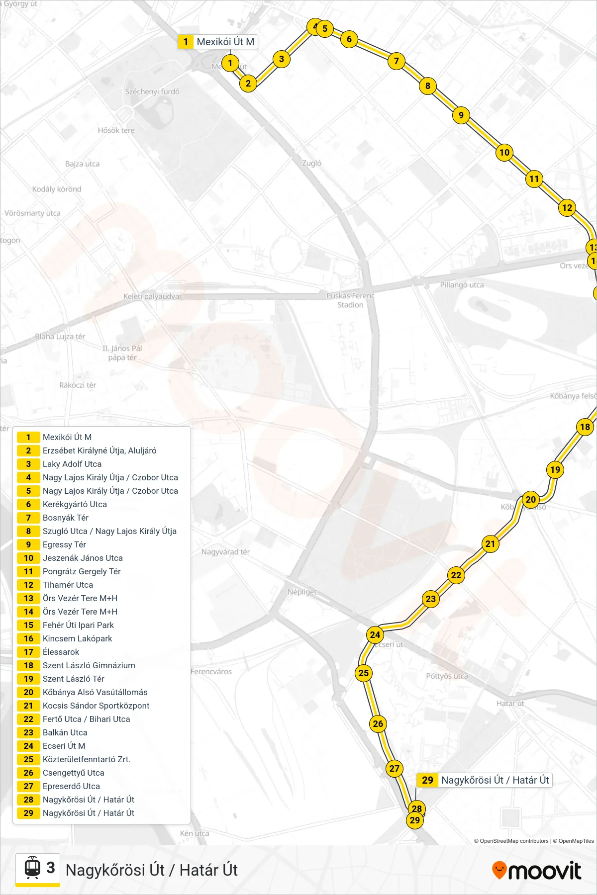
Stops list (3 - Nagykőrösi Út / Határ Út)
- Mexikói Út M
- Erzsébet Királyné Útja, Aluljáró
- Laky Adolf Utca
- Nagy Lajos Király Útja / Czobor Utca
- Nagy Lajos Király Útja / Czobor Utca
- Kerékgyártó Utca
- Bosnyák Tér
- Szugló Utca / Nagy Lajos Király Útja
- Egressy Tér
- Jeszenák János Utca
- Pongrátz Gergely Tér
- Tihamér Utca
- Örs Vezér Tere M+H
- Örs Vezér Tere M+H
- Fehér Úti Ipari Park
- Kincsem Lakópark
- Élessarok
- Szent László Gimnázium
- Szent László Tér
- Kőbánya Alsó Vasútállomás
- Kocsis Sándor Sportközpont
- Fertő Utca / Bihari Utca
- Balkán Utca
- Ecseri Út M
- Közterületfenntartó Zrt.
- Csengettyű Utca
- Epreserdő Utca
- Nagykőrösi Út / Határ Út
- Nagykőrösi Út / Határ Út