
3 Bus Route Map
View the 3 route map and see all 3 stops along the route. The map of 3 shows where the bus travels and the location of each stop, making it easy to understand the entire route at a glance.
Explore NT routes on the map and see where NT bus services operate. Use the 3 map to find bus stops and see how the 3 connects different areas along its trip.
All 3 stops on the map are displayed in route order, helping you follow the 3 bus from the first stop to the last.
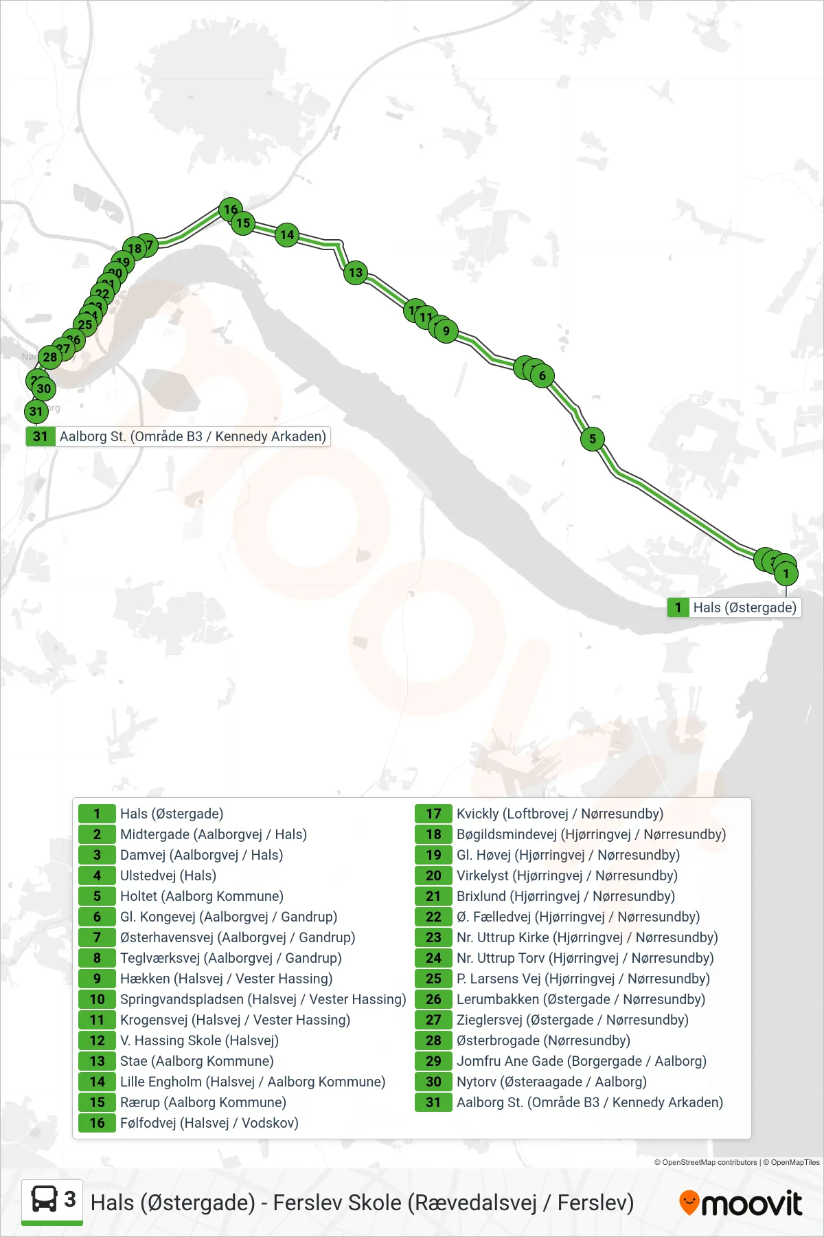
Stops list (3 - Aalborg St.)
- Hals (Østergade)
- Midtergade (Aalborgvej / Hals)
- Damvej (Aalborgvej / Hals)
- Ulstedvej (Hals)
- Holtet (Aalborg Kommune)
- Gl. Kongevej (Aalborgvej / Gandrup)
- Østerhavensvej (Aalborgvej / Gandrup)
- Teglværksvej (Aalborgvej / Gandrup)
- Hækken (Halsvej / Vester Hassing)
- Springvandspladsen (Halsvej / Vester Hassing)
- Krogensvej (Halsvej / Vester Hassing)
- V. Hassing Skole (Halsvej)
- Stae (Aalborg Kommune)
- Lille Engholm (Halsvej / Aalborg Kommune)
- Rærup (Aalborg Kommune)
- Følfodvej (Halsvej / Vodskov)
- Kvickly (Loftbrovej / Nørresundby)
- Bøgildsmindevej (Hjørringvej / Nørresundby)
- Gl. Høvej (Hjørringvej / Nørresundby)
- Virkelyst (Hjørringvej / Nørresundby)
- Brixlund (Hjørringvej / Nørresundby)
- Ø. Fælledvej (Hjørringvej / Nørresundby)
- Nr. Uttrup Kirke (Hjørringvej / Nørresundby)
- Nr. Uttrup Torv (Hjørringvej / Nørresundby)
- P. Larsens Vej (Hjørringvej / Nørresundby)
- Lerumbakken (Østergade / Nørresundby)
- Zieglersvej (Østergade / Nørresundby)
- Østerbrogade (Nørresundby)
- Jomfru Ane Gade (Borgergade / Aalborg)
- Nytorv (Østeraagade / Aalborg)
- Aalborg St. (Område B3 / Kennedy Arkaden)