
3 Bus Route Map
View the 3 route map and see all 3 stops along the route. The map of 3 shows where the bus travels and the location of each stop, making it easy to understand the entire route at a glance.
Explore Electra Afikim routes on the map and see where Electra Afikim bus services operate. Use the 3 map to find bus stops and see how the 3 connects different areas along its trip.
All 3 stops on the map are displayed in route order, helping you follow the 3 bus from the first stop to the last.
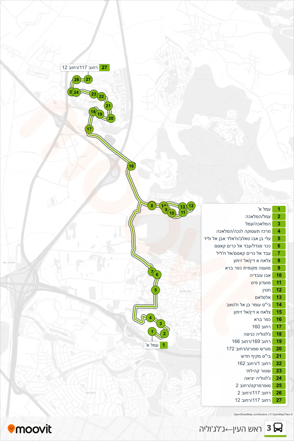
Stops list (3 - Rosh HaAyin→Jaljulia)
- Amal A
- Amal/HaMelacha
- HaMelacha/Amal
- Employment Center for Disabled/HaMelacha
- Ali ibn Abi Talib/Khalid ibn al-Walid
- Migdal Square/Abd al-Karim Qasim
- Abd al-Karim Qasim/Al-Khalil
- Salah al-Din/Al Zeitun
- Kafr Bara Local Council
- Abu Ubaidah
- Pais Club
- Hattin
- Al-Salam
- Omar ibn al-Khattab School
- Salah al-Din/Al Zeitun
- Kafr Bara
- Street 160
- Jaljulia Entrance
- Street 169/Street 166
- Sports Field/Street 172
- New High School
- Street 1/Street 162
- Community Police
- Jaljulia Exit
- Supermarket/Street 2
- Road 117/Road 2
- Street 117/Street 12