
3 Bus Route Map
View the 3 route map and see all 3 stops along the route. The map of 3 shows where the bus travels and the location of each stop, making it easy to understand the entire route at a glance.
Explore Manchester Transit Authority routes on the map and see where Manchester Transit Authority bus services operate. Use the 3 map to find bus stops and see how the 3 connects different areas along its trip.
All 3 stops on the map are displayed in route order, helping you follow the 3 bus from the first stop to the last.
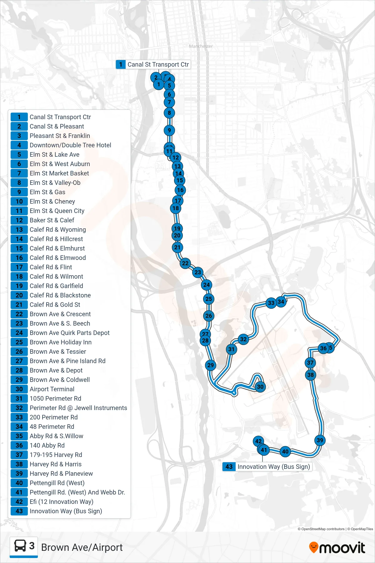
Stops list (3 - Airport Via Brown Ave)
- Canal St Transport Ctr
- Canal St & Pleasant
- Pleasant St & Franklin
- Downtown/Double Tree Hotel
- Elm St & Lake Ave
- Elm St & West Auburn
- Elm St Market Basket
- Elm St & Valley-Ob
- Elm St & Gas
- Elm St & Cheney
- Elm St & Queen City
- Baker St & Calef
- Calef Rd & Wyoming
- Calef Rd & Hillcrest
- Calef Rd & Elmhurst
- Calef Rd & Elmwood
- Calef Rd & Flint
- Calef Rd & Wilmont
- Calef Rd & Garlfield
- Calef Rd & Blackstone
- Calef Rd & Gold St
- Brown Ave & Crescent
- Brown Ave & S. Beech
- Brown Ave Quirk Parts Depot
- Brown Ave Holiday Inn
- Brown Ave & Tessier
- Brown Ave & Pine Island Rd
- Brown Ave & Depot
- Brown Ave & Coldwell
- Airport Terminal
- 1050 Perimeter Rd
- Perimeter Rd @ Jewell Instruments
- 200 Perimeter Rd
- 48 Perimeter Rd
- Abby Rd & S.Willow
- 140 Abby Rd
- 179-195 Harvey Rd
- Harvey Rd & Harris
- Harvey Rd & Planeview
- Pettengill Rd (West)
- Pettengill Rd. (West) And Webb Dr.
- Efi (12 Innovation Way)
- Innovation Way (Bus Sign)