
3 Bus Route Map
View the 3 route map and see all 3 stops along the route. The map of 3 shows where the bus travels and the location of each stop, making it easy to understand the entire route at a glance.
Explore Rīgas satiksme routes on the map and see where Rīgas satiksme bus services operate. Use the 3 map to find bus stops and see how the 3 connects different areas along its trip.
All 3 stops on the map are displayed in route order, helping you follow the 3 bus from the first stop to the last.
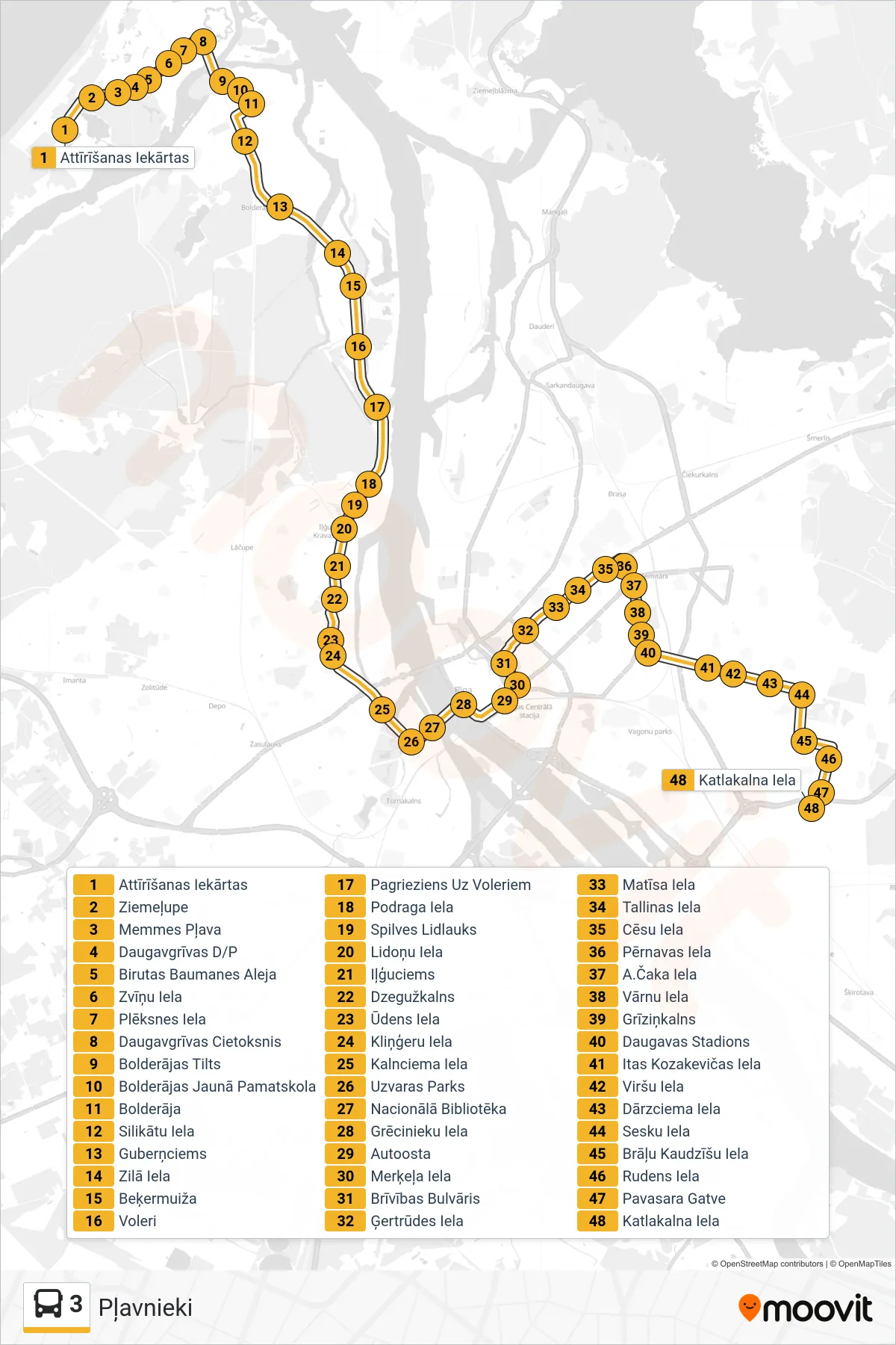
Stops list (3 - Pļavnieki)
- Attīrīšanas Iekārtas
- Ziemeļupe
- Memmes Pļava
- Daugavgrīvas D/P
- Birutas Baumanes Aleja
- Zvīņu Iela
- Plēksnes Iela
- Daugavgrīvas Cietoksnis
- Bolderājas Tilts
- Bolderājas Jaunā Pamatskola
- Bolderāja
- Silikātu Iela
- Guberņciems
- Zilā Iela
- Beķermuiža
- Voleri
- Pagrieziens Uz Voleriem
- Podraga Iela
- Spilves Lidlauks
- Lidoņu Iela
- Iļģuciems
- Dzegužkalns
- Ūdens Iela
- Kliņģeru Iela
- Kalnciema Iela
- Uzvaras Parks
- Nacionālā Bibliotēka
- Grēcinieku Iela
- Autoosta
- Merķeļa Iela
- Brīvības Bulvāris
- Ģertrūdes Iela
- Matīsa Iela
- Tallinas Iela
- Cēsu Iela
- Pērnavas Iela
- A.Čaka Iela
- Vārnu Iela
- Grīziņkalns
- Daugavas Stadions
- Itas Kozakevičas Iela
- Viršu Iela
- Dārzciema Iela
- Sesku Iela
- Brāļu Kaudzīšu Iela
- Rudens Iela
- Pavasara Gatve
- Katlakalna Iela