
3 Bus Route Map
View the 3 route map and see all 3 stops along the route. The map of 3 shows where the bus travels and the location of each stop, making it easy to understand the entire route at a glance.
Explore Stadtwerke Hamm GmbH - Verkehrsbetrieb routes on the map and see where Stadtwerke Hamm GmbH - Verkehrsbetrieb bus services operate. Use the 3 map to find bus stops and see how the 3 connects different areas along its trip.
All 3 stops on the map are displayed in route order, helping you follow the 3 bus from the first stop to the last.
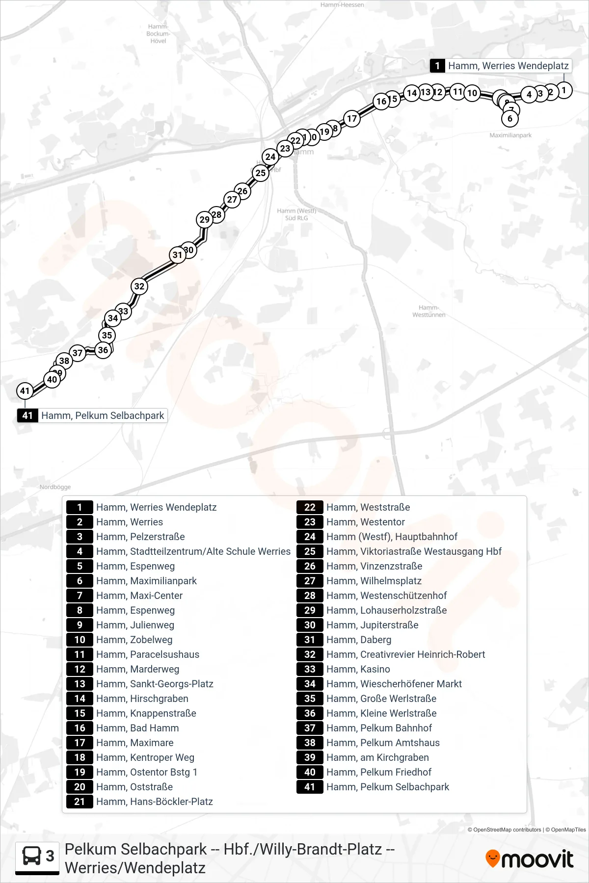
Stops list (3 - Hamm, Pelkum Selbachpark)
- Hamm, Werries Wendeplatz
- Hamm, Werries
- Hamm, Pelzerstraße
- Hamm, Stadtteilzentrum/Alte Schule Werries
- Hamm, Espenweg
- Hamm, Maximilianpark
- Hamm, Maxi-Center
- Hamm, Espenweg
- Hamm, Julienweg
- Hamm, Zobelweg
- Hamm, Paracelsushaus
- Hamm, Marderweg
- Hamm, Sankt-Georgs-Platz
- Hamm, Hirschgraben
- Hamm, Knappenstraße
- Hamm, Bad Hamm
- Hamm, Maximare
- Hamm, Kentroper Weg
- Hamm, Ostentor Bstg 1
- Hamm, Oststraße
- Hamm, Hans-Böckler-Platz
- Hamm, Weststraße
- Hamm, Westentor
- Hamm (Westf), Hauptbahnhof
- Hamm, Viktoriastraße Westausgang Hbf
- Hamm, Vinzenzstraße
- Hamm, Wilhelmsplatz
- Hamm, Westenschützenhof
- Hamm, Lohauserholzstraße
- Hamm, Jupiterstraße
- Hamm, Daberg
- Hamm, Creativrevier Heinrich-Robert
- Hamm, Kasino
- Hamm, Wiescherhöfener Markt
- Hamm, Große Werlstraße
- Hamm, Kleine Werlstraße
- Hamm, Pelkum Bahnhof
- Hamm, Pelkum Amtshaus
- Hamm, am Kirchgraben
- Hamm, Pelkum Friedhof
- Hamm, Pelkum Selbachpark